
A Divide in the Trans-Himalaya
The Parilungbi valley and the upper Pare Chu occupy separate drainages on either side of the pass, though both eventually contribute to the broader Spiti river system rather than forming a permanent divide between wholly independent river basins. Lahaul and Spiti district, whose pass records are maintained by the Government of Himachal Pradesh, encompasses a wide swath of the Trans-Himalaya; the district name references Lahaul and Spiti as a combined administrative unit, and Parang La sits firmly within the Spiti portion of that territory rather than in the Lahaul valley to the west.
The surrounding landscape at this elevation is characteristically sparse. When Thomas Thomson crossed the Parang Pass from Spiti toward Ladakh in September 1847, he recorded camping in a stony ravine at approximately 17,000 feet and observed scattered flowering plants growing among the rocks near the pass. His field account, published in Western Himalaya and Tibet in 1852, preserves a detailed record of the terrain he saw. Harish Kapadia’s book on Spiti, cited in the Japanese Alpine Club’s expedition report, describes the crossing as a historic trade route to Ladakh.
The 2005 JAC Tokai Expedition
The Japanese Alpine Club Tokai Section used Parang La as a corridor into the upper valley in the summer of 2005. The team departed Kaja on 23 July and crossed the pass on 26 July. The team then established base camp at the snout of the Parang Glacier, at 5,200 m. The Himalayan Journal account, written in the first person by a member of the section, describes the glacier approach and the pass as the route linking the Spiti-side trailhead to the objectives beyond.
One party within the expedition targeted an unnamed summit of 6,206 m situated west of the pass, reaching it on 2 August. The Indian Mountaineering Foundation's expedition report lists the locality and distinguishes this peak clearly from the pass itself. Crossing the pass enabled the expedition to reach the glacier and approach its two groups of climbing objectives.
Satellite View, 25 September 2026
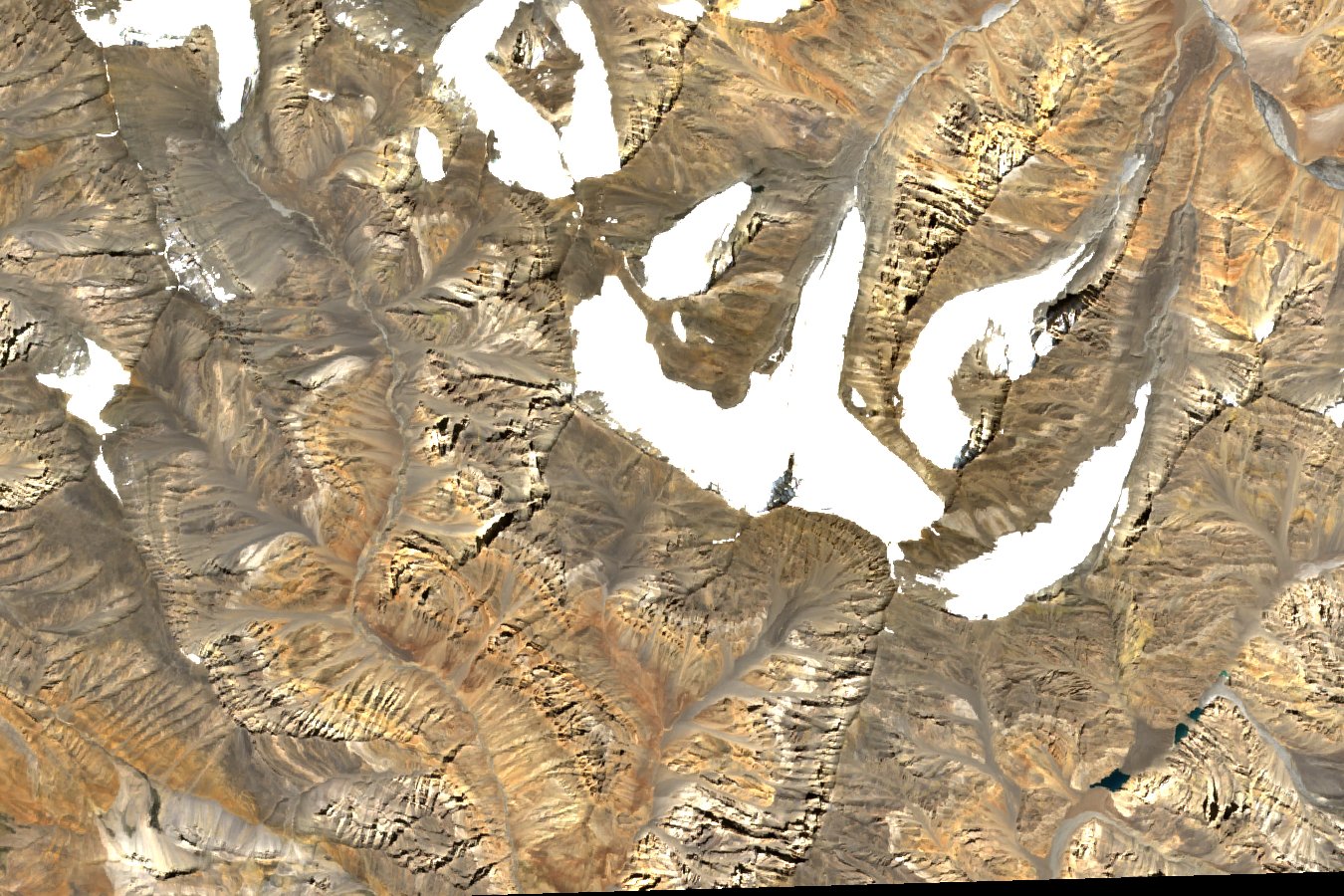
A Sentinel-2B Level-2A image acquired on 25 September 2026 shows Parang La near the centre of the frame, with the glacier to the northeast and the adjoining bare ridges extending on either side of the col. The ridges on both sides show how the col links separate valleys across a short section of the watershed.