
Position and Names
The Nepal government lists the peak as Pangbuk Ri under profile PANR. Nepal's 2013 tourism statistics use the spelling Panbuk Ri. Seyfferth's map gives the name as Pangbug. Ripimo Shar lies to the south and Lunag Ri to the north. The Pangbuk Glacier occupies the eastern flank. Pangbuk North, at 6,478 m and northeast of the main peak, received its first ascent in 2013.
The Nepal government profile and Erwin Schneider's chart both give 6,716 m. The HMG-Finn map, as cited by David Gottlieb, gives 6,625 m. The Himalayan Database also uses 6,625 m. H. Adams Carter's 1985 Himalayan classification lists the peak at 6,631 m.
Early Approaches
On 29 May 1952, Tom Bourdillon and Ray Colledge climbed a peak south of Menlung La during the Cho Oyu expedition. Michael Ward records the application of the name Pangbuk to that summit. The Himalayan Database now indexes this climb as Ripimo Shar. Pangbuk Ri in Nepal's present registry lies north of Menlung La. Its first ascent is recorded separately in 2011.
In 1955 Peter Boultbee and Dennis Davis approached from the Menlung Glacier, gained a snow shoulder on the west-southwest ridge, and were stopped by steep terrain above. Four years later a Japanese team attempted the peak. The original account by Hideki Kato records that Oishi reached approximately 6,100 m, with Abe and Ang Temba also involved in the attempt. A photograph of Pangbuk from Hadengi La, printed in the 1960 Japanese Alpine Club yearbook, documents the mountain as it appeared to that expedition.
The 2011 First Ascent
Gottlieb first observed Pangbuk Ri in 2009 while travelling with Joe Puryear. He returned in November 2011 with Chad Kellogg. Da Temba Sherpa transported expedition equipment to Lukla and supported the base camp operation. Gottlieb and Kellogg left advanced base in the early hours of 10 November 2011. They ascended the southeast face via the Pangbuk Glacier and threaded snow runnels upward. They reached the summit ridge during the night.
On 11 November 2011, Gottlieb and Kellogg reached the summit. They then descended the other side of the mountain. The total time from camp to camp, including descent, was approximately 50 hours. Their southeast face route is named Ghost Ride the Whip and gains 1,400 m.
Pangbuk Glacier Satellite View
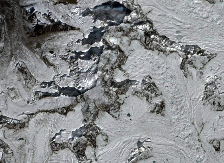
A true-colour Sentinel-2 image acquired on 3 October 2026 shows the Pangbuk Glacier east of the summit. In the north-up image the glacier appears on the right. Snow and ice abut exposed rock across the upper faces. The folds of the glacial basins are visible where snow accumulates against bare terrain.