
Rock hills on an open plain
The 1939 geological survey distinguishes rounded granite domes around Omaruru from Kranzberg, a separate high point to the southwest. Geologists call an isolated hill rising abruptly from lower ground an inselberg. A 2025 assessment describes the same pattern around the town, with hard granite hills scattered across a plain that gradually rises from west to east.
Granite, tourmaline and a river that runs after rain
Geologists surveying the railway corridor identified Damara-age granite at Omaruru Koppie and recorded a local occurrence of tourmaline. The nearby Erongo massif contains younger igneous rocks. Over time erosion exposed patches of resistant granite while wearing down the surrounding ground. The Omaruru River crosses the plain below the hills. Its sandy channel is often dry, but it carries water after heavy rains.
The settlement beside the river
The Omaruru municipal survey traces the town’s establishment to the Ovaherero leader Wilhelm Zeraua in 1863. A mission was built in the settlement in 1872. The 1939 survey noted shallow groundwater in the sand and gravel of the riverbed, even during drought. The river corridor thus held water beneath its dry surface while the Koppie gave people a landmark above it.
Sunlight signals and the 1904 photograph
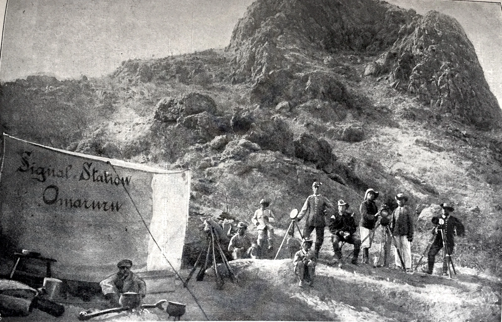
In 1902 German colonial authorities set up five fixed hill stations along about 200 kilometres from Karibib through Omaruru to Outjo. Operators angled mirrors to send flashes of sunlight, relying on a clear line of sight between stations. In the photograph from 1904, the signal crew stands with tripods below an exposed rock face. The station served the colonial administration and military. That year, Omaruru was also a site of Ovaherero resistance to German rule.