
Basalt Plateau and the Motete Blockstreams
The broad highlands are underlain by ancient basalt beds that remain nearly horizontal, so the plateau surface breaks into terraced forms wherever rivers have incised it. On a cold south-facing slope beside the Motete River near Afriski, geologists Alexandra Bregman and Jasper Knight documented three narrow accumulations of angular rock. These deposits are called blockstreams. They form as loose blocks move downslope, leaving a strip of rubble between stretches of vegetation. The largest of the three measured approximately 156 metres long and under 25 metres wide.
Bregman and Knight's study, formally published in Quaternary International in 2022, compared the weathering state and geometry of these deposits. Surfaces that rebound more strongly under a hardness test tend to be less weathered, and ridges visible within the rock mass suggest the deposit accumulated in more than one phase. The authors link these deposits to periods of colder conditions. How long ago the blocks moved remains uncertain.
Winter at Moteng Pass
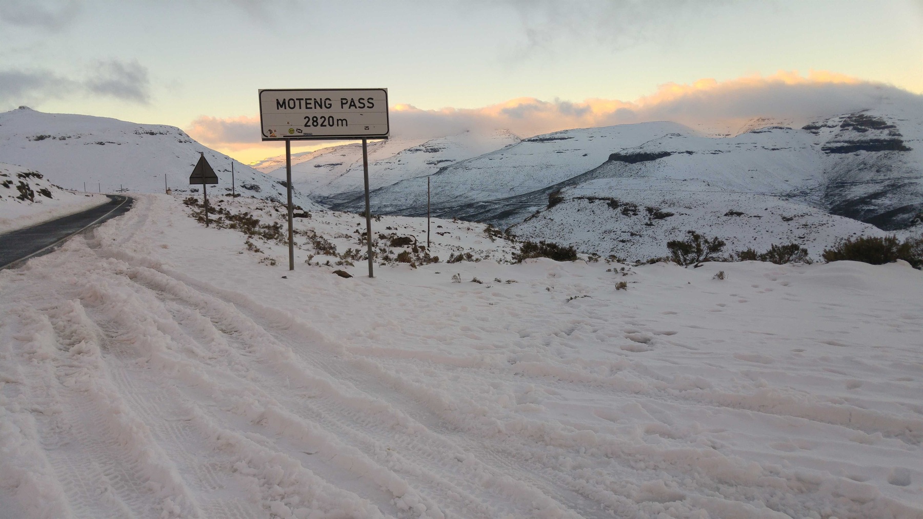
A July 2016 photograph taken at Moteng Pass shows the A1 road crossing snow-covered ridges, with several dark rocky bands exposed on the slopes and a roadside place sign marking the pass. On the ridge to the right, the dark bands in the snow reveal the stepped profile of the slope.
An Early Plan to Harness the Highlands’ Water
Interest in the northern highlands as a water source dates to the early 1950s, when studies by Ninham Shand proposed the Oxbow Project: a high dam, hydropower generation, and a tunnel through the Maloti range to transfer water to South Africa. South Africa initially rejected the proposal. Drought in the mid-1960s renewed interest, and subsequent studies evaluated alternative layouts over the following decades.
A bilateral treaty establishing the later Lesotho Highlands Water Project was signed in Maseru on 24 October 1986. The treaty followed separate feasibility studies of a wider network of reservoirs and transfer works.
The Khamane–Oxbow Road
The 22-kilometre Khamane–Oxbow section of the A1 was upgraded from gravel to paved surface, with traffic opening along the full section in April 1990. The African Development Bank's April 1999 evaluation found that drifting snow and ice complicated winter travel. The review also called for work to stabilize slopes cut into the hillsides.