
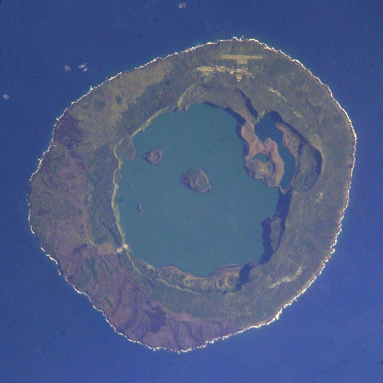
Summit and Caldera Geometry
The GVP records the summit at 260 metres, modest in absolute terms but representative of a shield whose true scale is hidden beneath the sea. The caldera measures roughly five kilometres across and contains Vai Lahi, a lake whose floor lies below sea level—an unusual condition that speaks to the depth and structural complexity of the collapsed interior. Small islands and cones cluster toward the northeastern shore of the lake, adding topographic variety to what might otherwise appear a simple basin.
Eruption Pattern and Flank Activity
Historical eruptions at Niuafoʻou have concentrated on the western and southern flanks rather than the caldera rim, a pattern documented in the GVP volcanic history. This flank-focused activity shaped the island's surface morphology and informed the understanding of where eruptive energy has been released over the documented record. The 1946 eruption was significant enough to force the evacuation of most of the approximately 1,200 inhabitants then living on the island, according to the same volcanic history—a measure of the eruption's reach and intensity.
Fissure Eruptions and Evacuation
Eruptions recorded since 1814 have often affected settlements on the west and south sides, where fissures have opened along the outer slopes. In 1946 an eruption forced most of the island’s approximately 1,200 inhabitants to evacuate. The Smithsonian’s catalogue also records the historical English name Tin Can Island.