
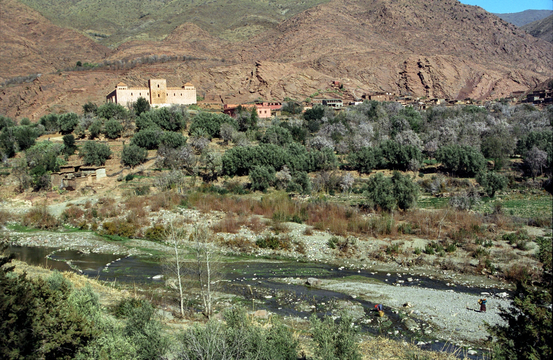
A fault corridor between Cambrian blocks
The Moroccan geological guide (Ministry of Energy Transition, vol. 3, p. 63) describes the Tinmel area as a crossing of the Tizi n'Test corridor, where the valley runs alongside the Tizi n'Test fault. Near the Ogdemt river, a tributary of the N'Fis, the alignment borders a fault zone marked by the Tadafelt and Wijddane blocks, which are composed of Cambrian rocks. These blocks are horsts — that is, upthrown compartments bounded by flanking faults. The N'Fis then descends the northern slope of the massif to join the Tensift system, draining a steeply graded catchment visible in the foreground of photographs taken at the level of Tinmel.
The Tinmel Mosque and the 2023 Earthquake
According to UNESCO, the Tinmel mosque dates to the twelfth century and is associated with the Almohad movement and the memory of its founder Ibn Toumert. Morocco inscribed it on its Tentative List in 1995. A photograph by Jerzy Strzelecki, first uploaded in October 2007 to Wikimedia Commons with a high-definition version in 2012, shows the monument in its valley landscape before any recent damage.
On 8 September 2023, an earthquake struck the region. In its assessment of 13 September 2023, UNESCO recorded very severe destruction at the Tinmel site.
Hydraulic regulation: Lalla Takerkoust and Yacoub Al Mansour
The Tensift Hydraulic Basin Agency dates the Lalla Takerkoust dam to 1935 and its raising to 1980; the structure serves power generation and irrigation. Upstream, near Ouirgane, the Yacoub Al Mansour dam was completed in 2008 with the aim of better regulating the N'Fis inflow before it reaches the main reservoir.
A World Bank analysis compares historical inflows at Lalla Takerkoust across two periods: the mean inflow recorded between 1981 and 2008 is 46% lower than that measured between 1941 and 1980. This figure applies to the two periods as defined in the document; it does not imply anything about trends beyond 2008.