
A River Rerouted by Geology
Otago geological research describes the Nevis River as a drainage once oriented southward through the Nokomai valley. As ranges in the region continued to grow, an eroding tributary of the Kawarau eventually captured the upper Nevis catchment and diverted the river to its present northward course toward the Kawarau. The lower gorge, from Nevis Crossing to that confluence, is the product of that realignment: the river now works through a canyon cut well below the broader basin floor, with steep walls of Central Otago schist visible along the channel.
The rerouting left a biological signal as well as a topographic one. A 2001 mitochondrial DNA study by Waters, Craw, Youngson, and Wallis found that the galaxiid fish of the Nevis had closer genetic affinities to Southland populations than to neighbouring Otago stocks, consistent with the former southward drainage connection. The Department of Conservation now identifies the divergent population occupying small waterways above the lower gorge as Nevis galaxias, Galaxias ‘nevis’, treating it as a distinct lineage. The 2013 Water Conservation (Kawarau) Amendment Order formally lists non-migratory native fish habitat among the protected values of the lower gorge reach.
Māori Occupation and the Gold Era
Heritage New Zealand lists the broader area as the Lower Nevis Historic Area (listing 7800), and the Department of Conservation records long Māori occupation of the valley without specifying exact settlement locations or a precise timeline from available published sources. Te Papapuni as the river's traditional name reflects that sustained presence in a landscape otherwise defined today by its geology and later European use.
Gold activity across the Nevis valley was being described in reports by November 1862, including at the lower end of the valley. A mining officer's report from May 1865, printed in the Otago Daily Times on 10 June of that year, described the lower reach as a rocky, sharply cut gorge in the final stretch before the river reached the Kawarau — an account that matches the landform visible in later photographs of the site and distinguishes this lower canyon section from the separate Nevis Gorge lying between the Upper and Lower Nevis districts.
The 134-Metre Platform
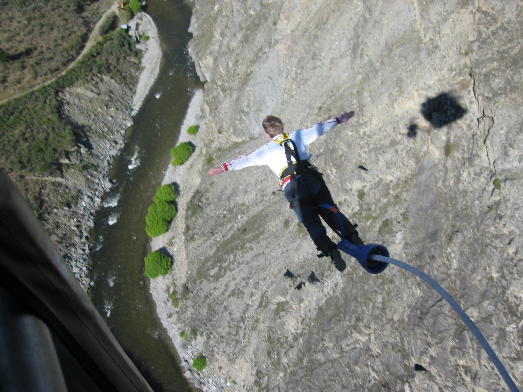
AJ Hackett Bungy documentation records that the Nevis bungee platform, suspended above the river at 134 metres, opened in 1999. A photograph taken by uploader Che010 on 2 October 2005 shows a jumper above Te Papapuni with the exposed schist walls and the river visible far below the platform structure, illustrating the vertical scale of the gorge at that point. This section of the lower gorge sits within the reach covered by the 2013 water conservation order, which protects both the river's flow characteristics and its native fish values.
The canyon's layered record — geological capture, endemic fish, Māori occupation, nineteenth-century gold reports, and a late-twentieth-century commercial installation — reflects the convergence of forces, biological and human, that the Nevis drainage has concentrated at this narrow exit to the Kawarau. The gorge itself, not the broader Nevis Valley or the unrelated Nevis Bluff on the Kawarau, is the geographical subject that ties these distinct threads together.