
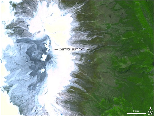
Structure of the complex: peaks, domes, and glacier
The ridge of Nevado del Huila brings together several peaks associated with distinct emission centers. The SGC has identified domes in the South Peak sector, a formation that reflects the effusive nature of some of the complex's volcanic episodes. The Central Peak, at 5,364 meters, is the reference geodetic vertex and the highest point of the Cordillera Central.
The complex supports an ice cover whose extent has changed over time. Glacial surface figures recorded in historical SGC reports correspond to specific points in the past and do not describe the current state of the glacier.
The phreatic eruptions of 2007
On February 19, 2007, Nevado del Huila recorded a phreatic eruption. The SGC documented the opening of a fissure between the Central Peak and La Cresta following that event, along with lahars that traveled down the Páez River basin. On April 18 of the same year a second phreatic eruption occurred, with lahars affecting the Páez and Símbola river basins.
Lahars are flows of volcanic material mixed with water and sediment that can travel down river valleys to inhabited areas downstream. The SGC recorded these flows as part of the 2007 eruptive process and documented them in both basins during the April phase.
The November 2008 eruption
In November 2008 Nevado del Huila produced a new eruption that generated lahars. The SGC recorded this episode within the complex's recent eruptive history, continuing the monitoring begun during the 2007 process.
The sequence documented by the SGC encompasses phreatic eruptions, the opening of a fissure at the summit, the presence of domes on the South Peak, and the generation of lahars in specific basins — features that characterize the complex's activity in the twenty-first century.