
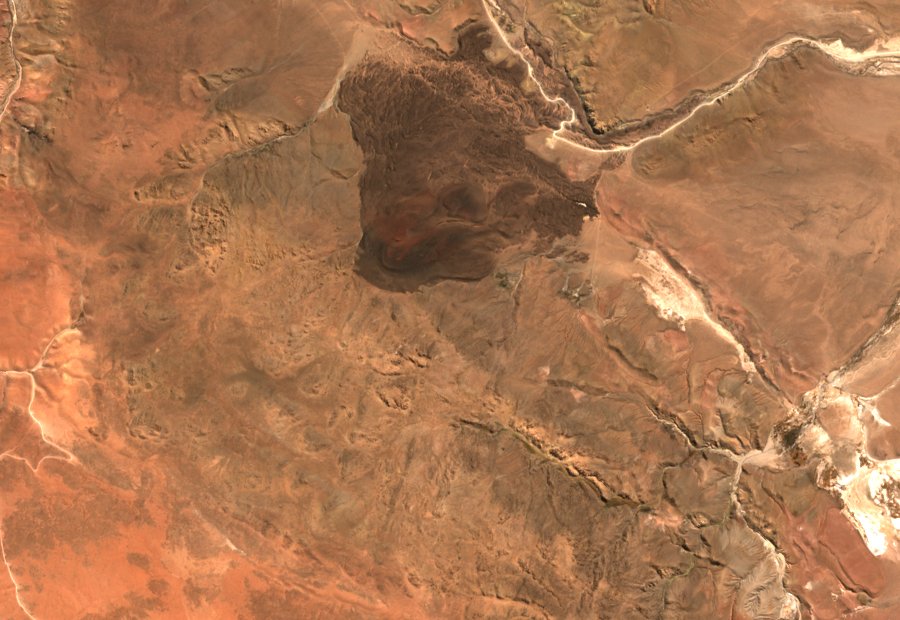
Cone, Lava Field, and What the Sentinel Image Shows
Fragments of lava thrown from a vent can pile up into a steep mound called a scoria cone. Flows of lava can spread much farther than the mound itself. At Negro de Chorrillos, Fernández-Turiel and colleagues mapped about 4.6 square kilometres of lava in 2021. The longest flow trace reaches roughly 4.5 kilometres from the vent.
In the 19 May 2026 Sentinel-2C image, the cone and lava field form a dark patch against the paler Puna slopes. The image shows the reach of the dark surface, while field mapping identifies the different deposits within it.
Radiometric Ages and What They Measure
K–Ar (potassium–argon) dating measures the ratio of radioactive potassium to its decay product argon in a collected rock sample — specifically in the groundmass, the fine-grained matrix of the lava. The resulting figure is the age of that particular sample's crystallisation, not a directly observed eruption date or a fixed birthday for the entire volcano. With that qualification in mind, Fernández-Turiel et al. (2021) dated a Negro de Chorrillos lava sample designated NdC-3 to 51 ± 2 thousand years before present, placing it in the Late Pleistocene. For comparison, a sample from the nearby but geologically distinct San Jerónimo volcano yielded 144 ± 3 thousand years. Both figures were younger than earlier published estimates for these centres, making the 2021 results a revision of the prior understanding rather than a confirmation of it.
The Late Pleistocene Debris Avalanche
Bustos et al. (2026, published 14 March) used digital elevation models combined with field observations to document that Negro de Chorrillos experienced a substantial partial collapse during the Late Pleistocene, affecting both the cone itself and its older lava field. The researchers estimated the total volume of displaced material at approximately 0.007 cubic kilometres — equivalent to roughly seven million cubic metres. Among the most striking field evidence: some lava blocks preserve intersecting fracture patterns and fit back against adjacent pieces like reassembled fragments, and at least one intact displaced block still retained portions of the original cone structure, indicating the collapse moved material without completely disaggregating it.
The stratigraphy of the lava field also points to a more complex history than a single eruptive episode. River deposits identified between distinct lava layers indicate pauses in volcanic activity, suggesting eruption was not continuous. Additionally, some layers contain the mica mineral phlogopite while others do not, a compositional difference consistent with at least two separate batches of magma reaching the surface at different times. Bustos et al. propose that the steep local slopes and fault influence contributed to the collapse, though these remain interpretations rather than proved causes. No chronological link has been established between the 51 ka K–Ar measurement on sample NdC-3 and the timing of the rock avalanche itself.
Documentary Record and Regional Setting
On 8 March 1979, the Salta Official Gazette used Negro de Chorrillos as a reference point in the published boundaries of a mineral prospecting application. The notice records how the cone served as a landmark; it does not establish whether exploration took place. In 2008, geologist Iván Petrinovic documented it for SEGEMAR alongside other small volcanoes of the eastern Puna.