
Landforms and Geology
Road cuts and stream banks around Narok expose volcanic rocks beneath the clay-rich topsoil. The Central Rift Valley Water Works Development Agency recorded basalt, volcanic breccia and weathered tuff. Tuff forms when material from an eruption, especially ash, accumulates and hardens into rock.
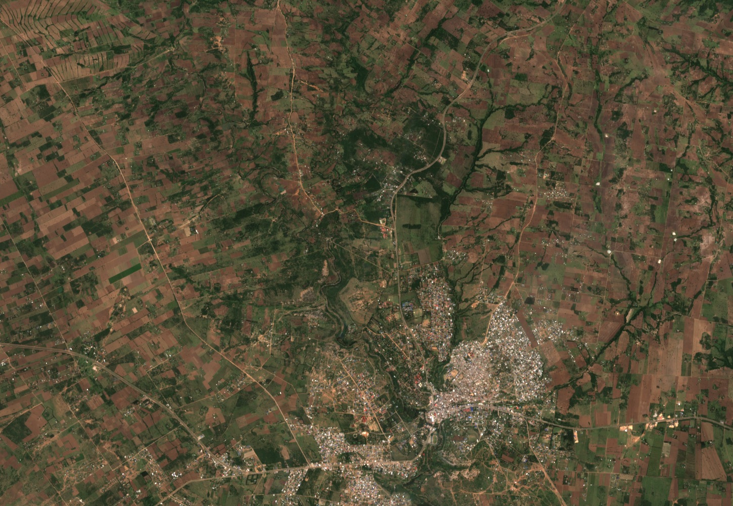
The wooded lines in the satellite image follow valleys between the fields upstream of town. The Kakia and Esamburmbur carry water in response to rainfall. The Enkare Narok continues to flow year-round and draws its water from farther upstream in the Mau Forest.
Watersheds and Land Cover Change
The Kakia basin covers 30.5 square kilometres and the Esamburmbur basin 15.7 square kilometres. A 2019 study by a Jomo Kenyatta University of Agriculture and Technology field team compared five Landsat satellite observations of these catchments between 1985 and 2019, tracing forest cover, rangeland, and agricultural land. Forest cover in those two study areas fell from 46.6 to 6.2 percent. Agricultural land reached 55.2 percent by 2019. Local interviews conducted during the same study referenced the Olopito and Morijo group ranches and noted agricultural expansion following ranch subdivision in the mid-1990s.
The researchers also tested how quickly the ground took up water. At their sampling sites the basic infiltration rate was about 89 centimetres per hour in forest, compared with 8 on rangeland and 15 on farmland. The differences help explain how changes in land use can affect the amount of stormwater reaching the channels. Farther downstream, the 2014 Narok town plan identified undersized crossings and construction in drainage corridors as factors that could worsen flooding.
The 27 November 2019 Flash Flood
On 27 November 2019, a short, intense storm sent a flash flood through the Kakia channel. At Maasai Mara University, one gauge recorded 18.7 millimetres of rain in 15 minutes. A channel that was dry between storms quickly carried water into the built-up part of Narok.
The engineers who reconstructed the flood surveyed the channel by drone in dry conditions. They used the images to build a surface model with five-centimetre pixels showing the channel, banks and bridges. They checked their simulation against high-water traces and photographs taken by residents. At the points where the simulation predicted the greatest extent, water was up to four metres deep and reached as far as 290 metres from the channel. The terrain survey and residents’ photographs record different parts of the event: how the ground could direct the water, and where the water was seen to go.