
The Cirque Landform and the Glacial Relic Hypothesis
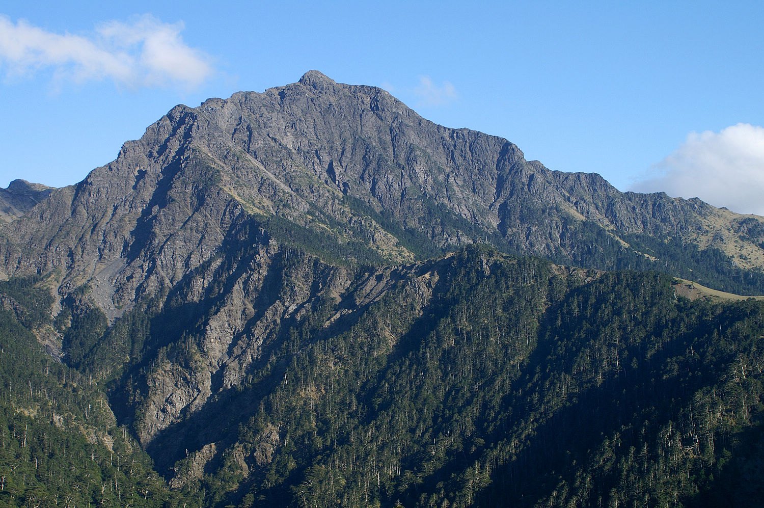
Nanhu Dashan's most geologically distinctive feature is the two broad cirques that have developed between the main summit and the east peak, arranged in an upper and lower tier. Some geologists interpret these two cirques as remnant landforms from glacial activity during the Last Glacial Maximum, arguing that their morphology is consistent with glacially eroded basins. This interpretation, however, remains within the realm of academic discussion and has not achieved scholarly consensus; it should be treated as a professional hypothesis rather than a definitive conclusion.
The spatial arrangement of the upper and lower cirque tiers gives the interior of Nanhu Dashan a topographic layering unlike that of most high mountains. Looking from the main summit toward the east peak, the two cirques unfold in succession, forming a compound cirque landscape rare among Taiwan's high peaks — should the glacial origin ultimately be confirmed, this site would become a key location for the study of Taiwan's high-mountain glacial history.
The Northern Peak of the Five Sacred Mountains: Name and Cultural Significance
The "Five Sacred Mountains of Taiwan" is a system within Taiwan's mountaineering culture, modelled on the concept of China's traditional Five Sacred Mountains, in which five representative high summits are assigned to the five cardinal directions — east, west, south, north, and centre — based on location and stature. Nanhu Dashan was designated the Northern Peak, both for its geographical position in the northern section of the Central Mountain Range and because the breadth of its massif and its prominent elevation suit the symbolic weight of a sacred peak. This designation is itself a cultural construct, reflecting the mountaineering community's systematic effort to organise a canon of indigenous Taiwanese peaks, rather than an official administrative or geological classification.
The Mountain Context of the Northern Central Mountain Range
The northern section of the Central Mountain Range, where Nanhu Dashan is located, is one of the most topographically complex segments of Taiwan's mountain system, with well-developed alpine flora and clear vertical altitudinal zonation. The designated boundaries of Taroko National Park encompass this area under unified protection; Nanhu Dashan and the eight nearby Baiyue peaks are all within the park's core alpine zone. It should be noted that the alpine ecology and vegetation distribution characteristics of this area as a whole form a regional background and should not be attributed solely to Nanhu Dashan as a single peak; understanding Nanhu Dashan requires situating it within the broader geographic context of the entire Nanhu mountain group.