
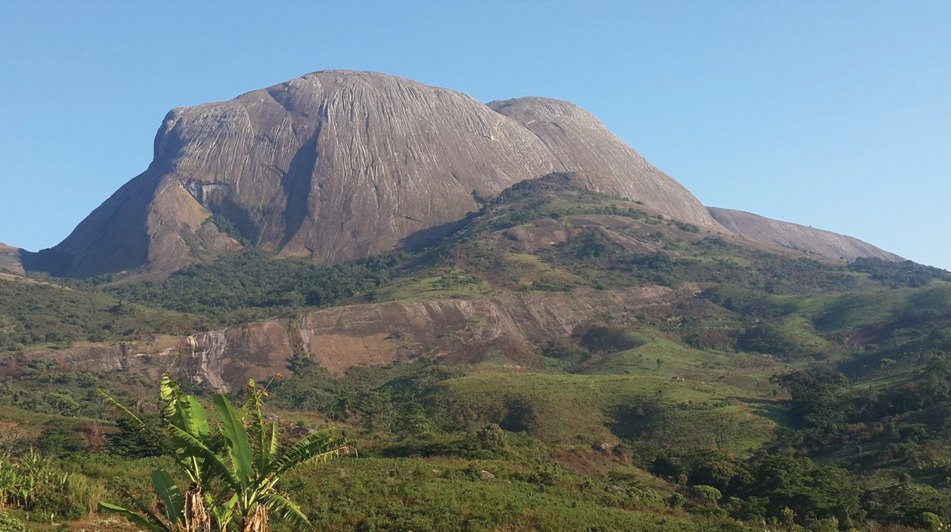
Terrain and Summit Pair
The main high point and its southwestern companion are connected by elevated plateau rather than a sharp ridge, and the Kew field survey lists the two as a pair of high points at 2419 m and 2369 m respectively. Surface model data from Copernicus GLO-30 confirms the northeast block as the higher of the two. The bare granite flanks give way on the southern side to exposed rock faces, with the southeast face presenting a near-continuous cliff above the surrounding forested slopes.
The massif sits in Gurué district, Zambézia Province, and its draining rivers feed systems on opposing sides of the massif. The Kew survey describes the geology as eroded granite brought to the surface through prolonged weathering, a process that produced the domed forms visible from the surrounding lowlands.
Early Recorded Visits
H.E. O'Neill passed through the vicinity and published a sketch in 1884 but, according to the Kew survey, did not enter the massif. Joseph Thomas Last reached the foothill settlement of Ana Guruwe on 3 August 1886, received hospitality there, and used it as a base for approximately three months. He estimated the mountain at around 8,000 ft without having climbed it, surveyed other summits in the area, and observed the broader landscape. A sketch map from that period was published in 1890. Kew archives list at least 79 plant and 16 fungal specimens from Last’s expedition.
An announcement in Nature in 1885 outlined plans for mapping the highlands and following the Licungo downstream.
The 2014 Southeast-Face Climb
American climbers Majka Burhardt and Kate Rutherford completed a 12-pitch route of approximately 600 m on the southeast face in May 2014, following a reconnaissance visit in 2011. Burhardt described it as the mountain’s first technical route in her 2015 American Alpine Journal account. The climb gave expedition members access to a small forest patch on the cliff at around 1600 m, and surveyors documented vegetation in a chimney system and sedge communities nearer the top. Flavia Esteves, Harith Farooq, Caswell Munyai, and local partners took part in the broader expedition fieldwork.
Lomwe Connections and Ongoing Fieldwork
The Kew field study records that Lomwe communities around Namúli relate their origins to the mountain. The survey documents that visitors who sought to climb Namúli itself requested permission from traditional custodians, a practice the authors recorded during their fieldwork. The 2014 expedition also engaged Lomwe community partners through what later became the Legado Initiative.
Nitidæ and collaborators are carrying out the NAMULI 2 project from January 2024 through December 2026, focused on sustainable farming and landscape protection across the massif. The massif is a Key Biodiversity Area and an Important Plant Area.