
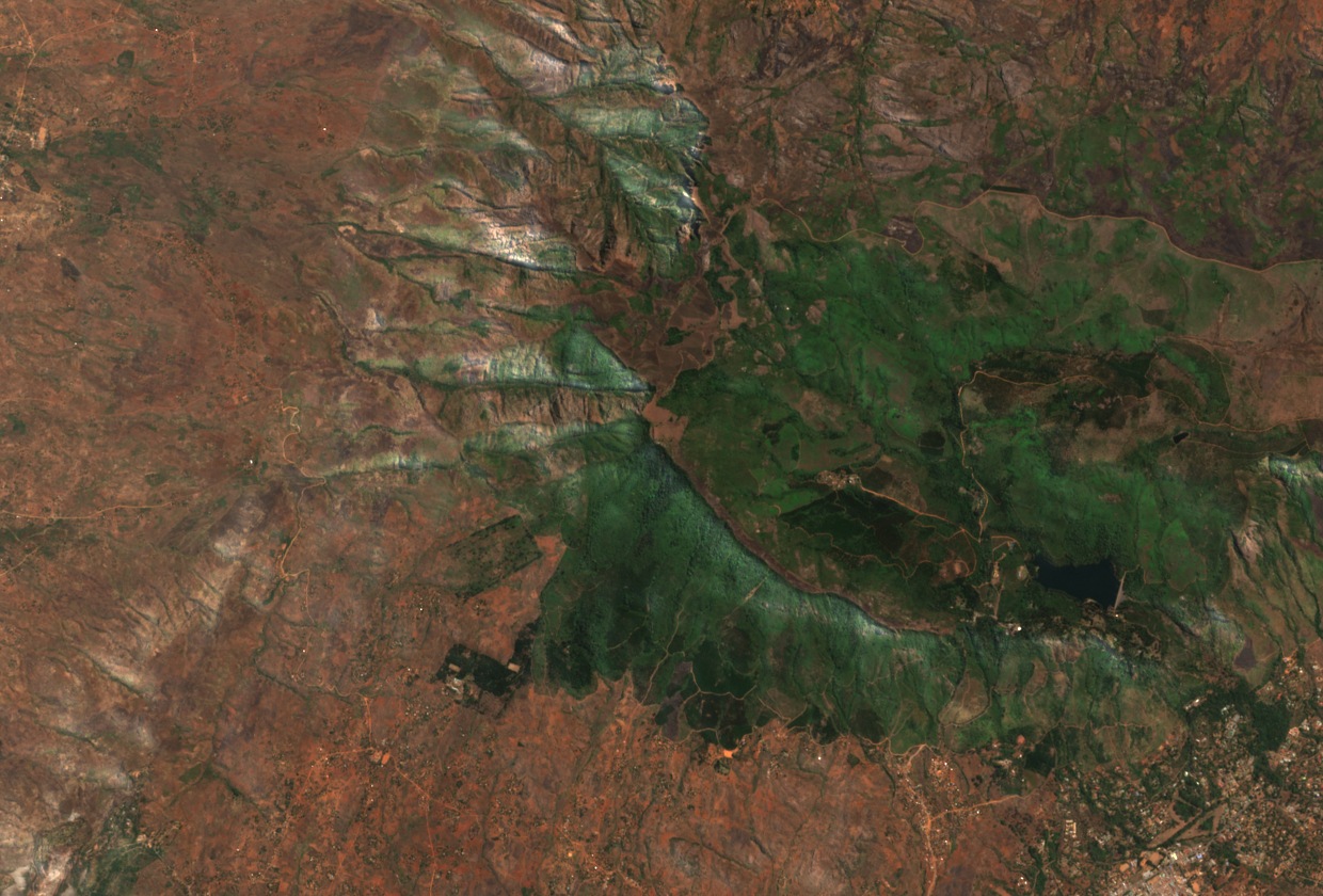
A Rocky Residual Above the Plateau
The 1965 Malawi Geological Survey describes what it called Chilumbi — the peak now named Mulumbe — as a rocky residual standing above the lower plateau surface. The igneous massif belongs to the Zomba–Malosa syenite–granite complex, emplaced approximately 113 million years ago, and long-term differential erosion of the surrounding rock has shaped the escarpments around the massif.
The documented named height of Mulumbe Peak is 2,087 metres, a figure appearing in published accounts of the Zomba Plateau massif. The Copernicus GLO-30 digital elevation model, which represents terrain sampled at 30-metre grid intervals, places the western high point of the plateau at a cell value of 2,083.4 metres.
The Mulunguzi Watershed
The upper Mulunguzi River originates in a marsh near the peak and, according to the 1965 Malawi Geological Survey, flows west toward the gap between Chilumbi and Chiradzulu, a neighbouring summit within the same massif, then drops over a series of falls before turning east through a broad valley and a narrow gorge toward Zomba town. The 1965 Geological Survey proposed that this drainage course reflects a partial reversal caused by faulting at some point in the landscape's history.
Southern Region Water Board planning documentation records that the Mulunguzi catchment later came to supply the city of Zomba with water. The relationship between the river's upper course near the peak and the downstream supply infrastructure reflects the plateau's role as a regional water source, independent of any single geological event.
The Western Escarpment and Slope Terrain
The Zomba Tour Guides Association describes a ridge route that passes Mulumbe Peak and continues to Chingwe's Hole, from which the Shire Valley is visible across the western escarpment. A 2024 national geomorphological analysis, drawing on 2019 field inventories, logged a debris flow on terrain within the broader western upper plateau at approximately 0.8 kilometres from the mapped peak position, placing the event in the escarpment zone.
The terrain photograph is a natural-colour Sentinel-2 image acquired on 4 September 2025. In it, ridges around the high point give way westward to the lower valley beyond the escarpment, while the plateau extends eastward with valleys cut inward from its margins.