
Survey and Cartography
In 1959 John S. Humphreys and colleagues worked in the broader Mukut Himal area north of Dhaulagiri II, using a theodolite for triangulation to fix surrounding terrain. Their 1961 account records an ascent of nearby Tongu Peak on 18 October 1959 and an attempt on Hangde on 21 October 1959, establishing a cartographic framework for the ridge system without reaching the 6,087-metre summit. H. Adams Carter's later American Alpine Journal tables carried forward coordinates for the region, anchoring the peak in the historical record alongside neighbouring summits.
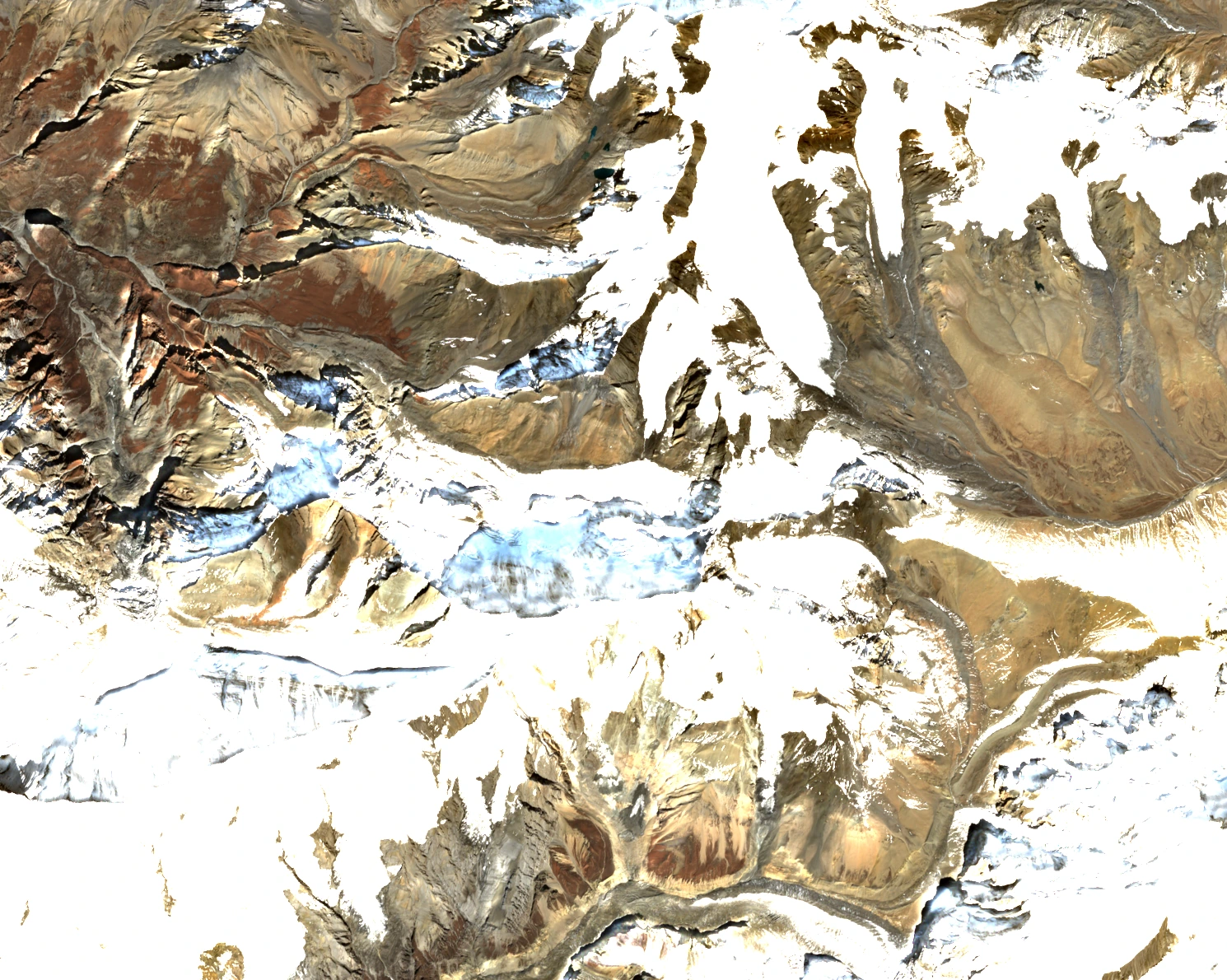
The snowy and rocky ridge of Mukut Himal sits in the upper centre of a true-colour Sentinel-2 image from 26 October 2025. The ridge and surrounding terrain appear heavily snow-covered on that date.
First Ascent
On 11 November 1967, Alfons "Fons" Driessen, Michiel van Mourik Broekman, Phu Dorje Sherpa, and Tenzing Gyatso Sherpa reached the summit by starting on the west ridge, crossing the north-northwest face, and continuing up the upper north ridge. The seven Dutch expedition members were led by Johannes "Dolf" Noordijk, and the Royal Dutch Mountaineering and Climbing Association archives the team records and photographs from this ascent.
Routes and Later Ascents
Nepal added Mukut Himal to its permitted peaks list in 2014, an event noted in both 2016 and 2021 American Alpine Journal reports. Adrian Sommers's team made the first ascent after official opening, summiting on 17 October 2015 via the northwestern side to the north ridge; Kami Sherpa, Mingma Dorje Sherpa, and Gelgin Sherpa fixed the majority of the 600-metre route for that effort. In late April 2016, Rhys Jenkins, Ian Richardson, and David Spooner approached from the east through Hidden Valley, establishing a high camp near 5,400 metres before gaining the north ridge and reaching the summit.
According to the Himalayan Database, French climbers Julien Jean Louis Dromard and Julien Albert Constant Iche, along with Nepali climber Lhakpa/Lakpa Sherpa, reached the summit on 16 January 2025.
Glacial Research in the Hidden Valley
Hidden Valley, centred near 28°50′N, 83°30′E north of Dhaulagiri, has been a research site for glaciological field measurements since at least the 1970s. Koji Fujita and colleagues compared data collected in 1974 and 1994 and found that Rikha Samba Glacier retreated approximately 200 metres over those two decades, with an area-average surface lowering of 12.6 metres ice equivalent and an estimated loss of 13 percent of the glacier's volume during that study period.