
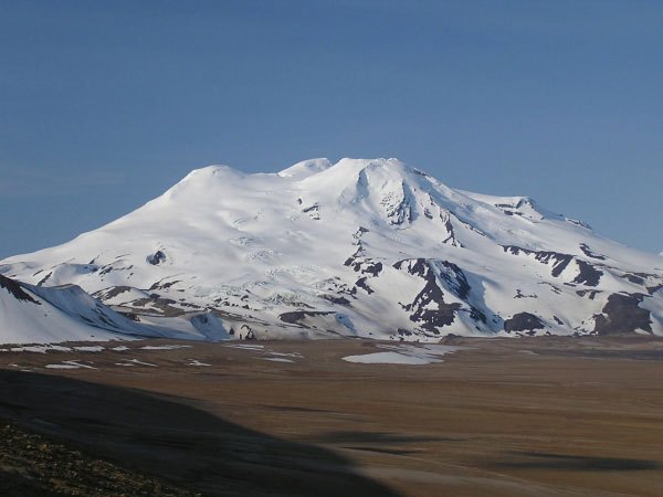
A Summit of Overlapping Forms
The four peaks composing Mount Mageik's summit include a central lava dome and separate summit cones. Between the central and eastern summits lies an explosion crater approximately 300 meters across, which the Global Volcanism Program dates to roughly 2,400 to 2,500 years ago. The crater holds a shallow acidic lake rimmed by fumaroles. The East Mageik cone produced multiple Holocene lava flows directed toward Katmai Pass.
Flank Instability and the 1912 Connection
Avalanche deposits on the southern flank reached Martin Creek, evidence of mass-wasting on the lower slopes. The Alaska Volcano Observatory records a landslide associated in time with the 1912 Novarupta eruption in the broader Katmai region, though that event represents a slope failure rather than an eruption of Mageik itself. Eruptions attributed to the mountain between 1927 and 1946 appear in some catalogs but are not confirmed by current sources.
Position Within the Katmai Cluster
Mount Mageik stands near Katmai Pass at the head of the Valley of Ten Thousand Smokes. Mount Martin lies to the south and the Trident complex to the northeast, each a distinct volcanic structure within the same cluster.