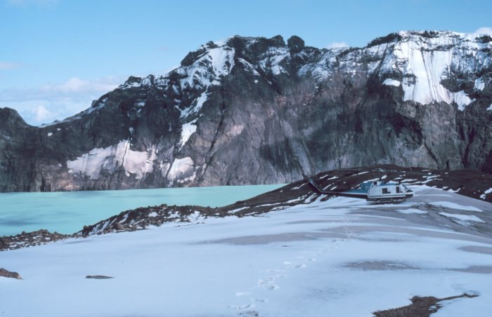
Mount Katmai rises to 2,047 meters on the Alaska Peninsula, its profile defined by a caldera formed by subsurface collapse during the June 1912 eruption. The eruptive vent opened at Novarupta, a site near Trident approximately 10 kilometers to the west, and it was there that volumes of rhyolite, dacite, and andesite were expelled. As magma drained from the system, Katmai's summit lost its structural support and fell inward, producing the caldera visible today. That collapse accounts for roughly 40 percent of the estimated 13 cubic kilometers of magma released during the episode, a figure derived from USGS compositional studies comparing 1912 deposits with older material across the volcanic cluster.
The Valley of Ten Thousand Smokes
The Valley of Ten Thousand Smokes lies west of the volcano near the Novarupta vent. Hot ash-flow deposits from the 1912 event blanketed the valley floor. For years afterward, gases escaping through the compacted tuff gave the valley its name, though those fumaroles have since diminished.
Seismic Activity and the Eruption Sequence
Large earthquakes occurred during and after the 1912 eruption. USGS field studies mapped volcanic products across the cluster as a whole, covering deposits from multiple centers in the region.
Caldera and Long-Term Eruptive History
Prior to 1912, Mount Katmai had its own eruptive history documented through older deposits mapped during USGS investigations of the broader volcanic cluster. The 1912 caldera, now partly filled by a crater lake, represents the most recent chapter in that record.