
Plateau Terrain and Topography
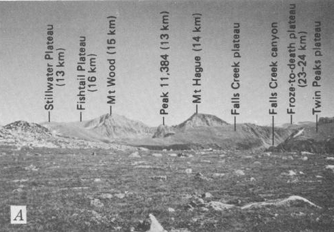
The Beartooth northeast flank combines broad rolling plateaus with steep-walled canyons cutting through them. The USGS topographic quadrangle for the area shows the Stillwater and Fishtail plateaus and Woodbine Creek in relation to the summit. The 1976 USGS study recorded the peak at 12,661 ft; the Montana State Library inventory gives 12,649 ft. Both figures are approximations of a summit around 3,860 m.
North Face Ascent
Warren Bowman and Robert Miller climbed the northern face on August 31, with Bowman publishing a first-person account in the 1970 American Alpine Journal. The report describes the transition from ice to rock on the face and the discovery of a summit register left by James Lakey. Bowman recorded his belief that the northern face had not previously been climbed.
Summit Context in the Beartooths
The annotated USGS figure 3A, published in 1976, identifies Mount Wood and Mount Hague as the two prominent summits visible from the plateau near Cathedral Peak, anchoring the peak within a photographically documented portion of the Beartooth high terrain. The Stillwater County location places the summit on the northern portion of the range, within the landscape of plateaus and creek drainages shown on the Mount Wood quadrangle.