
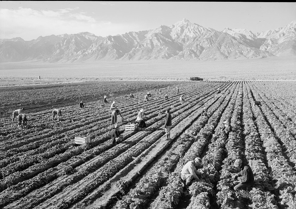
Position on the Crest
The mountain rises in the southern Sierra Nevada just east of the main crest, its eastern faces above the Owens Valley. The USGS named-summits table ranks Williamson above every California summit except Mount Whitney.
A Name from the Survey Era
The mountain's name comes from the California Geological Survey's 1865 published account, in which Clarence King recorded a point higher than Tyndall lying to the northeast and named it for Robert Stockton Williamson. Williamson was a U.S. Army engineer who directed surveys for Pacific railroad routes through California and Oregon in the 1850s. King's work at Tyndall was separate from reaching Williamson's summit.
Early Ascents
Francis P. Farquhar, drawing on the Sierra Club Bulletin, attributes an early ascent to William L. Hunter and C. Mulholland around 1884, though the precise year is uncertain.
Manzanar and the Adams Photograph
In 1943 Ansel Adams photographed farm workers at Manzanar with Mount Williamson in the background. The Library of Congress holds that image. Manzanar, in the Owens Valley below the Eastern Sierra, was a site of US wartime forced incarceration of people of Japanese ancestry during World War II.