
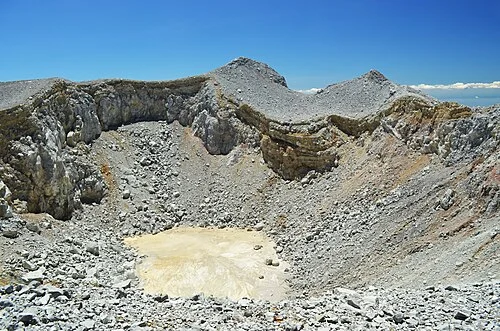
Volcanic Architecture and Landforms
The Arjuno–Welirang complex rests on and around the remnant Ringgit edifice, an older volcanic foundation underlying portions of the system. Welirang's northern flank hosts small pyroclastic cones documenting episodes of localised output. Fumaroles active at several summit locations deposit sulfur, a visible product of the geochemical processes operating beneath the mountain.
Eruptive Record
The Smithsonian Institution's Global Volcanism Program records small confirmed eruptions associated with the Arjuno–Welirang complex in 1950 and 1952, involving ash and gas emissions. Precise attribution of each event to the Welirang summit depends on the explicitness of the underlying source documentation for those episodes.
Monitoring and Regional Context
The Indonesian Geological Agency monitors the Arjuno–Welirang complex through the Tretes station, tracking geophysical and geochemical parameters across the system and including the complex in Indonesia's national volcano baseline catalogue. The Indonesian Geological Agency survey establishes Welirang at 3,156 metres and neighbouring Arjuno at 3,339 metres as distinct summits within a shared volcanic system above the Indo-Australian subduction zone.