
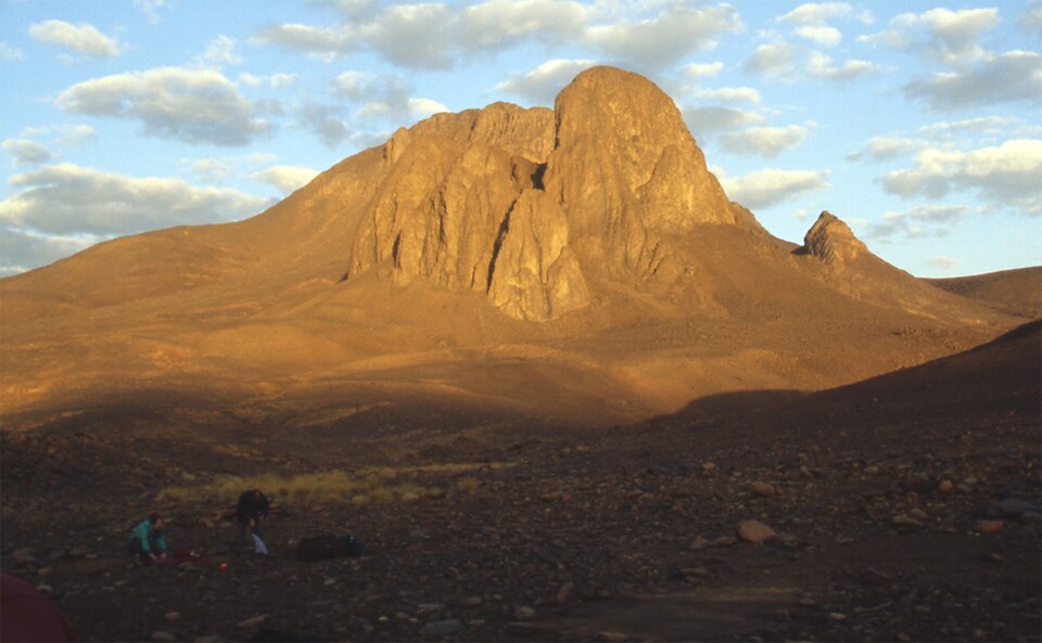
The Phonolite Dome
Azzouni-Sekkal and colleagues identify the summit of Tahat as a phonolite dome formed near the end of the earliest major phase of Atakor volcanism, which they date to the Miocene. A phonolite dome accumulates where viscous lava builds upward rather than spreading outward across the terrain. Tahat therefore represents a preserved endpoint of that early eruptive phase. The Atakor structure rests on an older Precambrian basement, portions of which are exposed where erosion has removed the overlying volcanic material.
Plateau Lavas, Scoria Cones, and the Wider Field
The broader Atakor field produced extensive plateau lavas that spread across the landscape at regional scale — a different volcanic form from the localized vertical accumulation of the Tahat dome. Younger scoria cones are present across the field, recording eruptive activity distinct from the Miocene phase that produced Tahat. Satellite imagery analyzed in the CNES study shows marked color differences between the older Precambrian bedrock and the younger dark lava surfaces, a distinction clear at regional scale.
Tamanrasset and the Ahaggar Setting
Mount Tahat lies within the central Atakor massif near Tamanrasset, the main populated centre of the Ahaggar region. The Ahaggar Mountains, also called the Hoggar, form one of the major mountain massifs of the Sahara, with the Atakor as their central volcanic core. The CNES Geoimage programme, which studies French and international territory through satellite imagery, highlighted Tamanrasset and the Hoggar Massif as a subject of interest, describing it as one of the great mountain massifs of the Sahara.