
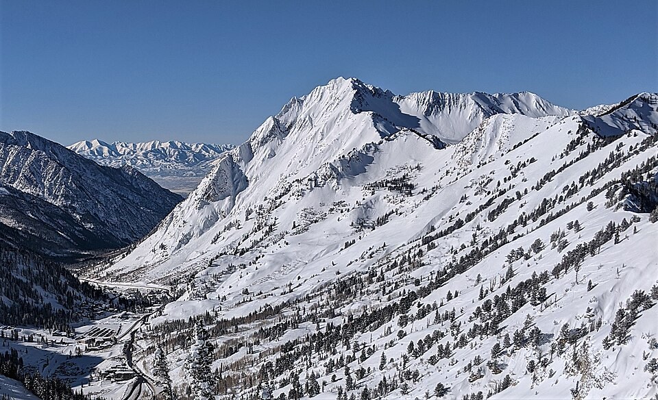
A Divided Crest
The mountain presents two summits separated by a narrow ridge. The eastern point at about 3,367 meters is what local usage refers to as Mount Superior, while the higher western point near 3,390 meters is commonly known as Monte Cristo. The U.S. Geological Survey's Geographic Names Information System assigns its Superior Peak label to the western point, a discrepancy that reflects the gap between cartographic convention and the names used by people in the canyon below.
Avalanche Terrain
The Utah Department of Transportation's avalanche path map identifies a Superior path descending the south-facing slopes toward the floor of Little Cottonwood Canyon. The steep character of that face has shaped avalanche research and transportation planning for the canyon road.
Thomas Moran's 1879 Watercolor
In 1879 the painter Thomas Moran depicted Mount Superior from Alta in watercolor and graphite. The Amon Carter Museum of American Art notes that Moran rendered the scene as uninhabited despite active mining operations in Alta at the time. The work was acquired by the critic John Ruskin in the 1880s and survives as a record of how the mountain was perceived and represented in that period, not as documentation of its physical conditions.