
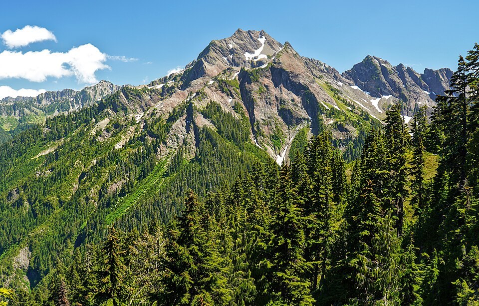
Terrain and Setting
The USGS topographic sheet plots Mount Steel as a steep summit in close proximity to the Duckabush valley drainage. It stands distinct from the neighboring Mount Duckabush and should not be confused with Yukon's Mount Steele, a separate peak in a different range entirely. La Crosse Basin lies to the north, and the mountain's flanks drop sharply toward the valley below.
The O'Neil Expedition and the Origin of the Name
The National Park Service historic resource study lists Mount Steel among place names associated with the 1890 O'Neil expedition, which passed around the mountain's north side on its route to O'Neil Pass. The name commemorates William Gladstone Steel, who supported the venture and published its route map in 1891. The name appeared on maps before the GNIS board action of 1961, which records a formal decision rather than the initial use of the name.
William Gladstone Steel and Regional Conservation
Steel's connection to the Olympic Mountains forms one strand of a wider career in Pacific Northwest exploration and land protection. He became most closely associated with the campaign to establish Crater Lake National Park in Oregon, a cause that defined much of his public life. The Olympic place name links this single summit to that larger conservation history, joining a landscape he helped bring to wider attention with the region he worked most persistently to protect.