
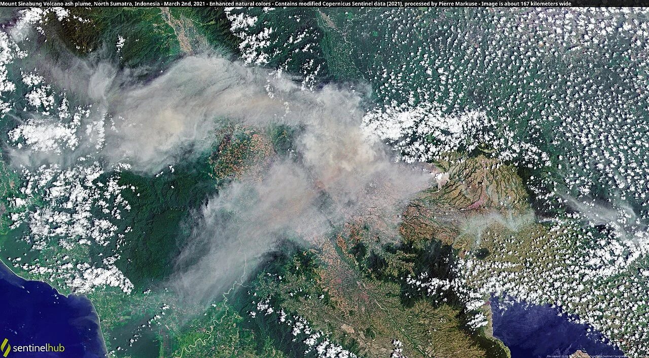
Architecture and Geological Context
Sinabung's profile is that of a classic stratovolcano, its flanks constructed from alternating layers of solidified lava, ash, and pyroclastic material deposited across multiple eruptive periods. The four overlapping summit craters arranged north to south reflect successive phases of volcanic activity, each new vent establishing itself slightly southward of its predecessor. This structural lineation distinguishes Sinabung from the more symmetrical cones found elsewhere in Sumatra's volcanic arc.
Radiocarbon dating of a pyroclastic-flow deposit on the volcano's southeastern flank, as reported in research cited in the Smithsonian Global Volcanism Program profile, indicates an age range of approximately 740 to 880 CE — placing confirmed volcanic deposits well into the first millennium. An 1881 eruption record exists but remains uncertain, and fumarolic activity was reported in 1912. The first confirmed modern eruption occurred in 2010. The existence of these earlier deposits underscores a geological biography far longer than any written account, though the precise pattern and frequency of early activity remain incompletely understood. No exact dormancy interval can be assigned on current evidence.
The 2010 Reawakening
The Smithsonian Global Volcanism Program identifies August 2010 as the beginning of Sinabung's first confirmed historical eruptive period. The United States Geological Survey records a phreatic eruption — a steam-driven explosion generated when groundwater or surface water contacts hot rock or magma — on 28 August 2010. This initial phase was distinct in character from later activity: driven primarily by the rapid vaporisation of water rather than the direct emission of fresh magma, it produced explosive surface expressions without necessarily indicating immediate large-scale magma ascent.
The significance of this eruption lies partly in its position within the historical record. No confirmed eruptive activity had been documented before 2010, though earlier pyroclastic deposits existed and an 1881 eruption record remained uncertain. The 2010 event marked the beginning of a confirmed modern eruptive chapter and drew broader scientific attention to a system whose earlier activity had left only fragmentary evidence.
Escalation: Phreatomagmatic and Dome-Forming Phases
By 2013, the character of Sinabung's activity had shifted substantially. The USGS documents magma-water interactions — phreatomagmatic explosions — during this period, in which rising magma came into direct contact with groundwater, producing more energetic and ash-rich eruptions than the earlier steam-only events. This distinction matters geologically: phreatomagmatic eruptions can generate finer ash columns and more unpredictable blast geometries than purely magmatic events, reflecting the volatile chemistry introduced by external water.
In the latter part of 2013, activity transitioned again, this time toward lava-dome growth within the summit area. As viscous magma accumulated and built a dome, episodes of instability caused portions of that structure to collapse, generating block-and-ash currents — fast-moving mixtures of hot rock fragments and gas — that travelled southward down the volcano's flanks, following the topographic gradient established by the southern crater's position. By 2014, the USGS records a further shift toward lava-flow growth alongside continued dome instability, a progression that illustrates how a single sustained eruptive sequence can cycle through fundamentally different eruptive styles as subsurface conditions evolve.
Sinabung in the Landscape of Sumatran Volcanism
Understood within the broader context of Sumatran volcanism, Sinabung occupies a distinctive position. It sits about 80 kilometres north-northwest of the Toba caldera, within the same tectonic framework — the subduction of the Indo-Australian Plate beneath the Sunda Block. The geographic proximity of these two systems makes the Karo Plateau an instructive landscape for observing the range of volcanic scales and styles that a single subduction zone can produce.
Sinabung's four-crater summit, its radiocarbon-dated prehistoric flows, and its well-documented modern eruptive sequence together make it a reference case for the study of stratovolcano reactivation — the process by which a system with no historical record of eruption reasserts itself across a geological timescale. The directional pattern of its 2013–2014 block-and-ash currents toward the south, consistent with the position of the youngest crater at that end of the summit axis, illustrates how structural geometry can shape the pathways of volcanic hazard even as the underlying eruptive style continues to evolve.