
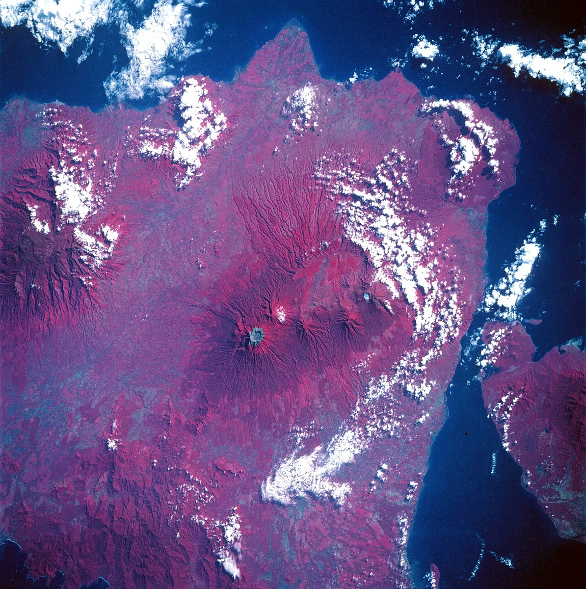
A Crater Within the Summit Caldera
The most distinctive feature of Raung's summit is its nested architecture. The outer caldera wall drops steeply away from the rim, enclosing a broad depression approximately two kilometres in diameter. Rising from the floor of that depression is a younger pyroclastic cone — a secondary structure built from successive eruptions — that itself contains a crater. This arrangement means that the visible summit is not a simple peak but a layered record of volcanic episodes, each generation of activity constructing new material within the shell left by the last.
Raung, located in East Java, is a distinct volcano from Ruang of North Sulawesi. The 3,260-metre figure given here comes from the Smithsonian Global Volcanism Program's current profile.
Ancient Collapse on the Western Flank
The geological summary maintained by the Global Volcanism Program documents a prehistoric mass-wasting event associated with the neighbouring edifice of Gunung Gadung on Raung's western flank. That collapse produced a debris avalanche whose deposit can be traced approximately 79 kilometres from its source — a scale that underlines how profoundly large volcanic flanks can reshape surrounding terrain when structural failure occurs. The event predates historical observation and belongs to Raung's deep geological record rather than its documented eruptive history.
The 2014–2015 Eruption Cycle
The Smithsonian Global Volcanism Program reported thermal anomalies at Raung beginning in 2014, followed by confirmed lava activity inside the summit caldera and ash emissions in 2015. On 12 July 2015, NASA's Aqua satellite captured a drifting ash and gas plume using its MODIS instrument, providing visible evidence of the eruption's atmospheric reach. Landsat 8 imagery from the same period showed thermal signatures consistent with active material at the surface of the caldera floor.
The 2015 activity extended its effects well beyond East Java. Ash dispersal disrupted regional aviation, with Bali's international airport among the facilities affected. The episode illustrates how eruptions at an interior East Java volcano can carry consequences across the broader Indonesian archipelago, given the density of air routes threading through the region and the unpredictability of volcanic plume trajectories at altitude.