
A Landscape Built and Then Remade
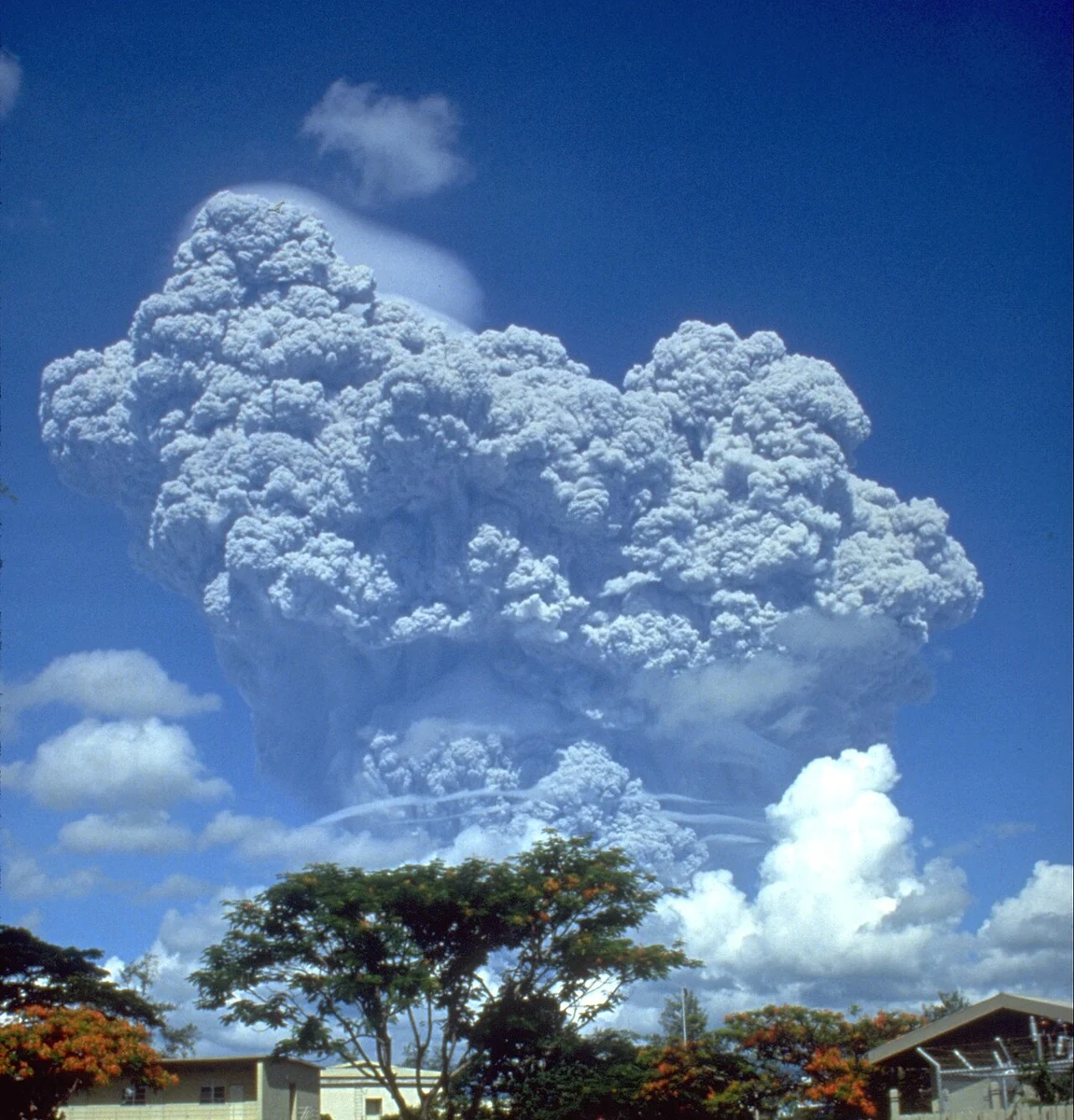
Pinatubo's pre-1991 form was itself the product of earlier eruptive cycles, with deposits from prior episodes preserved in the stratigraphy around the mountain. The dome complex supported mature forest and showed no surface features that made its volcanic potential immediately obvious to casual observation. That character changed irrevocably on 15 June 1991, when explosive activity reached its climax and the summit collapsed inward, forming a caldera roughly 2.5 kilometres wide and lowering the peak by more than 300 metres. In the years following, water accumulated within the caldera depression, gradually developing into the crater lake that now occupies the summit basin.
The timing of the climactic eruption coincided with the landfall of Typhoon Yunya, a conjunction that compounded damage in ways neither hazard alone would have produced. Heavy rainfall mixed with freshly deposited ash, increasing the load on structures and accelerating the mobilisation of loose volcanic material. The interaction between the eruption and the typhoon's meteorology also affected wind patterns near the climax, altering how ash dispersed across the region.
Lahars and the Long Aftermath
Pyroclastic flows, ash fall, and the caldera collapse were the immediate signatures of 15 June, but the hazard landscape around Pinatubo extended well beyond that single day. In the seasons that followed, rainfall remobilised vast quantities of fresh volcanic debris from the flanks and surrounding river valleys, generating lahars — fast-moving slurries of water and volcanic sediment — that inundated lowland communities repeatedly over subsequent years. The distinction between the eruption's direct products and these secondary lahar events matters for understanding the full scope of the mountain's impact: the pyroclastic and ash hazards were concentrated around the eruption itself, while lahars represented a prolonged, rain-triggered cycle of destruction that continued to evolve with each wet season.
The monitoring effort coordinated by PHIVOLCS and the USGS in the weeks before the climax produced joint hazard maps and evacuation guidance that directed the movement of populations from high-risk zones. That coordinated response is credited with greatly reducing fatalities relative to the scale of the eruption. The event became a reference case in volcanic risk management, cited for demonstrating what systematic monitoring and community-level hazard communication can accomplish under emergency conditions.
Sulfur Dioxide and the Stratospheric Signal
Among Pinatubo's globally significant legacies is the mass of sulfur dioxide it injected into the stratosphere during the 1991 climax. USGS research estimated this quantity at approximately 17 million metric tons — a figure large enough to initiate a chain of atmospheric chemistry beginning with the conversion of sulfur dioxide into sulfate aerosols. Those aerosols spread through the stratosphere over the months following the eruption, forming a reflective veil that reduced the solar energy reaching the Earth's surface and produced a measurable, temporary cooling of global mean temperatures. It is the sulfate aerosol layer, not the fine ash, that atmospheric scientists identify as the principal driver of this long-range climatic effect; ash settled relatively quickly, while the aerosols persisted at altitude for an extended period.
Pinatubo's atmospheric contribution is documented through stratospheric sulfate aerosol measurements that captured its global reach and placed it alongside a small number of historical eruptions whose scale left a detectable signature in climate records. The event provided researchers with a natural experiment for testing models of volcanic forcing on climate, and the resulting body of work has informed both volcanology and atmospheric science. The Smithsonian Global Volcanism Program situates 1991 within a longer sequence of activity; older volcanic deposits record even more extensive prehistoric pyroclastic flows and lahars, indicating that earlier episodes exceeded the 1991 eruption in scale.
The Caldera Lake and the Mountain Today
The crater lake that formed in the collapse depression following 1991 has become the most visible surface expression of what the eruption left behind. Fed by rainfall and contained within the roughly 2.5-kilometre caldera, the lake occupies the space where the former dome summit stood before the collapse lowered the peak by more than 300 metres. The surrounding landscape bears the layered record of the eruption in its topography — the reworked valleys, the flattened flanks, and the sediment plains that lahar episodes extended into the lowlands over successive rainy seasons.
Pinatubo sits within a broader geological province in Central Luzon that includes other volcanic features, and its eruptive deposits interact with the drainage systems that descend toward densely populated areas of the plain. The mountain's history as a forested, apparently dormant highland that abruptly expressed one of the century's largest eruptions has shaped how volcanologists approach similar dome complexes elsewhere — particularly the challenge of assessing hazard potential where long repose periods obscure the underlying volcanic system's state.