
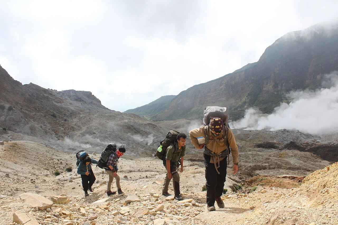
Elevation and Crater Topography
The Indonesian Geological Agency assigns Papandayan an elevation of 2,665 meters. The Smithsonian Global Volcanism Program lists the volcano at 2,643 meters and records the Alunalun crater subfeature at 2,665 meters.
Among the several named craters that constitute the summit complex, Kawah Mas — translated as the Golden Crater — is distinguished by its sulfur-bearing fumaroles, which give the feature its name. Active fumarolic fields of this kind are characteristic of persistently restless stratovolcanoes and reflect ongoing hydrothermal circulation within the edifice well outside of discrete eruption episodes.
The 1772 Collapse and Its Lasting Landform
The event most consequential to Papandayan's present shape occurred in 1772, when a reported eruption was accompanied by the collapse of the volcano's northeast sector. The collapse generated a debris avalanche that traveled into the surrounding lowlands, producing large-scale impacts on the terrain below. What remained at the summit was a northeast-facing horseshoe-shaped opening, a form that the Geological Agency's documentation explicitly describes and that remains one of the mountain's identifying structural features.
In 1772 the volcano's northeast flank underwent a sector collapse, producing a debris avalanche that caused extensive losses in the lowlands. The collapse left a horseshoe-shaped opening that remains a defining feature of Papandayan's morphology.
The 2002 Eruption Sequence
In November 2002 Papandayan produced multiple eruption phases. Minor activity had been reported in 1998, and the November 2002 sequence involved ash emissions and lahars moving through drainages on the volcano's flanks. The Nangklak crater was specifically implicated, and deposits from that episode have been studied as part of the eruption's stratigraphic record.
The 2002 eruption is notable as a documented modern event that added new depositional layers to a summit zone already shaped by the far older 1772 collapse. Together, these two episodes — separated by more than two centuries — illustrate the episodic but recurring character of Papandayan's activity and explain why its crater complex presents such varied and geologically layered terrain to those who study it.
Regional Context and the Mooi Garoet Geopark
Papandayan sits within the broader volcanic landscape of Garut Regency in West Java, a region the Geological Agency has studied under the Mooi Garoet geopark framework. The name Mooi Garoet, meaning Beautiful Garut, reflects a regional identity in which volcanic landforms, including Papandayan's altered crater fields and the geothermal expressions of Kawah Mas, are understood as part of an integrated geological and cultural heritage. The geopark study positions Papandayan not as an isolated peak but as one node within a connected suite of volcanic and geomorphological features that characterize this part of the Sunda volcanic arc.