
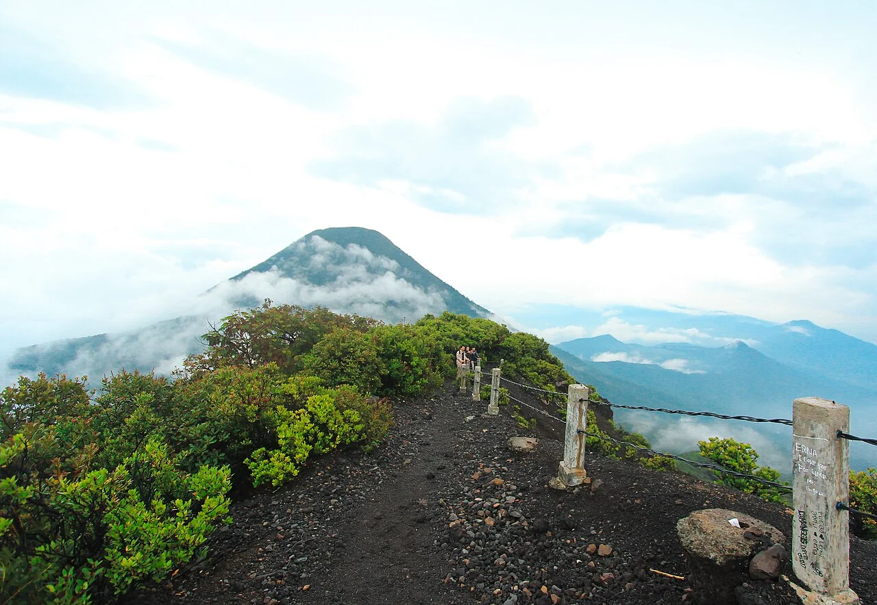
A Summit Built on Older Ground
The Smithsonian Global Volcanism Program describes Pangrango's summit cone as having been constructed on the northeast rim of that ancient caldera, a relationship that places the peak at the edge of a much larger former edifice rather than at the center of its own independent volcanic history. Separate from Gede's well-documented historical eruptions — which should not be attributed to Pangrango — the older volcano's surface expression includes an extinct crater situated to the northwest of the summit. The Indonesian park authority describes this feature as approximately 250 meters across and covering about five hectares, a modest but geomorphologically distinct depression that marks the final phase of Pangrango's eruptive past.
The Kandang Badak saddle links Pangrango and Gede at an elevation UNESCO places at approximately 2,400 meters, forming a high col that physically separates the two peaks while connecting them within a single national park established in 1980. This shared administrative boundary has long encouraged researchers and visitors to treat the two mountains as a unit, but their geological ages, eruptive histories, and summit morphologies are distinct, and the elevation difference — Pangrango higher by roughly 61 meters on the ministry figure — reflects that underlying divergence.
Published Elevation Values
Three separate authorities assign three separate elevations to Pangrango: the Indonesian Forestry Ministry and Geological Agency agree on 3,019 m; the Smithsonian Global Volcanism Program lists 3,026 m, identifying Pangrango as a subfeature of the Gede-Pangrango complex and using that figure as the complex high point; and the UNESCO Man and the Biosphere Programme public page for the Cibodas Biosphere Reserve cites 3,109 m. The reasons for this divergence are not established in the available reporting. The ministry figure of 3,019 m is used throughout this guide as the official Indonesian government value, but readers consulting scientific literature or international databases will encounter the other figures.
Forest Zones and Altitudinal Change
The Cibodas UNESCO Biosphere Reserve profile, which covers the broader landscape surrounding the Gede-Pangrango massif, places particular emphasis on the montane and subalpine forest zones concentrated around the 2,400-meter elevation band — roughly the altitude of the Kandang Badak saddle. This transitional zone is noted for its ecological studies and for the degree of Java-endemic species it supports, a concentration that reflects both the island's long isolation and the altitudinal compression that pushes distinct vegetation communities into relatively narrow vertical bands on a tropical peak.
As elevation increases toward the Pangrango summit, the character of the vegetation shifts in ways the park's conservation profile highlights as scientifically significant: closed-canopy montane forest gives way progressively to more open subalpine growth forms, with species composition tracking temperature and moisture gradients across a vertical range of only a few hundred meters. The national park designation in 1980, combined with the Cibodas UNESCO status, has sustained the long-term ecological monitoring that makes these altitudinal gradients among the better-documented on any Indonesian volcanic peak, even as the precise summit elevation itself remains a matter of differing survey records.
The Gede-Pangrango Complex in Context
Although the two peaks share a national park and are frequently discussed together in both scientific literature and conservation policy, Pangrango's identity as the geologically older and topographically higher summit gives it a character distinct from Gede's more historically active profile. The extinct crater northwest of the Pangrango summit, the ancient caldera rim on which the cone sits, and the altitudinally compressed forest zones rising toward 3,019 m are the features that define this mountain on its own terms — a dormant edifice whose scientific importance lies less in volcanic hazard than in the ecological record preserved across its slopes.