
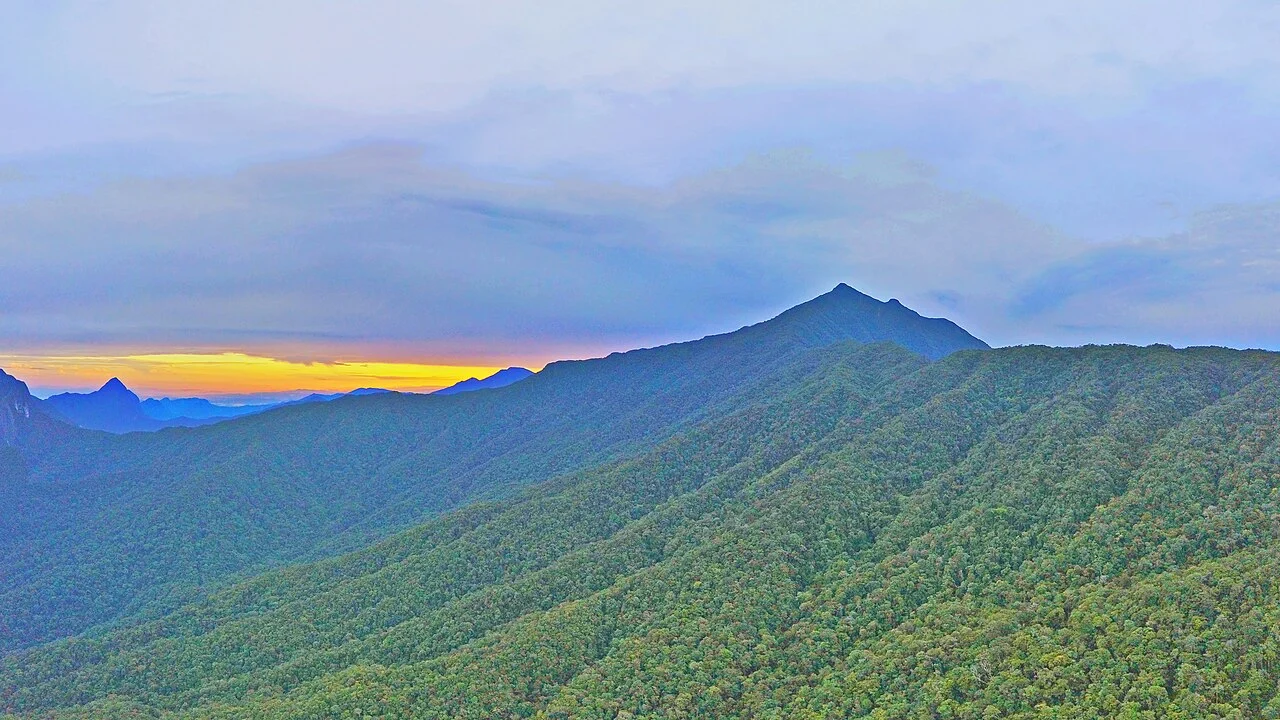
A Sandstone Summit in a Limestone Landscape
Mount Mulu reaches 2,376 metres — a figure recorded in the UNESCO World Heritage documentation, where broader overviews sometimes round the elevation differently. The summit is built from the Mulu Formation, a sequence of sandstone and shale laid down during the Paleocene and Eocene epochs. This is a critical distinction within the park: the towering limestone pinnacles and the celebrated cave systems belong not to Gunung Mulu itself but to the adjacent Melinau Limestone, which culminates in the separate summit of Gunung Api at 1,682 metres. Understanding the park requires holding both formations in mind simultaneously — the sandstone massif that defines the skyline and the limestone terrain that harbours the underground world below.
The national park surrounding the mountain records seventeen distinct vegetation zones, and UNESCO documentation notes an extraordinary diversity of palms across the wider landscape. That botanical richness reflects the park's range of substrates and altitudes, from lowland forest through montane moss forest toward the sandstone ridgeline of the summit itself — a vertical transect through some of the most intact rainforest canopy remaining in Malaysian Borneo.
The Cave Systems of the Melinau Limestone
Although the caves lie in terrain geologically separate from the sandstone summit, they are inseparable from any account of Gunung Mulu National Park. Deer Cave, carved through the Melinau Limestone, shelters populations of cave swiftlets and bats at a scale that shapes the ecosystem of the surrounding forest. Lubang Nasib Bagus contains Sarawak Chamber, whose approximate dimensions — recorded by UNESCO as roughly 600 metres long, 415 metres wide, and 80 metres high — convey the chamber's exceptional scale without requiring an unqualified claim to any current superlative ranking, since survey technology and the discovery of other large chambers may bear on such comparisons over time.
The relationship between the cave network and the surface topography illustrates how the Melinau Limestone has been dissolved and sculpted by water moving through a system that the surface geography only hints at. The pinnacles visible above the forest canopy on Gunung Api represent the resistant remnants of that same limestone after weathering has stripped away surrounding material — a process operating over geological time on a massif that sits adjacent to, but structurally separate from, Gunung Mulu's sandstone core.
The 1977–78 Royal Geographical Society Expedition
The systematic scientific exploration of the cave systems took shape through a 15-month expedition organised by the Royal Geographical Society at the invitation of Sarawak authorities, running from 1977 into 1978. The expedition's caving teams worked through the limestone terrain of the park rather than the sandstone summit, and between March and May 1978 they mapped more than 34 kilometres of passages within Gunung Api and more than 8 kilometres in Gunung Benarat. The Mulu Caves Project records that the expedition was built around a partnership involving local people alongside the scientific teams and Sarawak authorities — a collaboration that shaped both the methods and the reach of the fieldwork.
The exploration did not end with that expedition. A subsequent 1980 expedition extended the mapping work and included the survey of passages that led to the documentation of Sarawak Chamber within Lubang Nasib Bagus. These successive phases of cave mapping are distinct from any history of ascents of the sandstone summit above — the underground and surface geographies of the park developed their scientific records along separate timelines, each demanding its own precise chronology.
UNESCO Inscription and the Park's Scientific Legacy
UNESCO inscribed Gunung Mulu National Park in 2000, recognising the site's outstanding universal value across geological, biological, and geomorphological criteria. The inscription encompasses the full complexity of the landscape: the sandstone summit of Gunung Mulu, the limestone massif of Gunung Api with its pinnacles, and the cave systems developed through the Melinau Limestone over geological time. That breadth is what distinguishes the park from sites celebrated for a single dramatic feature — here the caves, the pinnacles, the summit, and the forest canopy are expressions of different underlying formations brought into proximity by the tectonic and erosional history of Borneo.
The documentation assembled through the Royal Geographical Society expeditions, subsequent caving projects, and the UNESCO nomination process has made the park one of the most carefully described karst and sandstone landscapes in the humid tropics. The palm diversity recorded in the wider park, the bat and swiftlet populations of Deer Cave, and the passage dimensions of Sarawak Chamber all entered the scientific record through sustained fieldwork conducted in partnership with local communities and Sarawak's governing authorities — a model of collaborative documentation that the Mulu Caves Project has continued to maintain.