
Structure and Landform
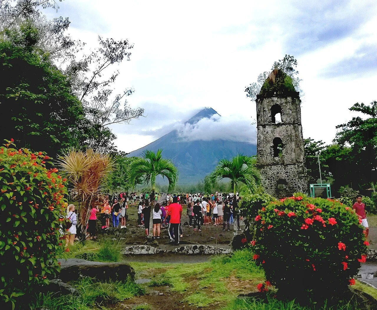
Mayon is a stratovolcano standing 2,462 metres, topped by a small summit crater from which numerous radial ravines descend the flanks in every direction. That radial pattern is not incidental to the mountain's character — it is the principal mechanism by which erupted material and water-borne lahars are routed downslope. The cone's symmetry reflects successive accumulations of lava flows and pyroclastic debris; each eruptive episode adds new material that reinforces the same conical profile, while erosion between events deepens the ravines that separate each radial ridge.
The rock record of this accumulation is tangible at ground level. The National Museum of the Philippines has identified andesite boulders originating from the 1814 and 1984 eruptions, physical evidence of how individual events contribute distinct layers and projectiles to the landscape around the volcano's base. Andesite is the characteristic rock of many arc volcanoes, and the boulders preserved from these two eruptions illustrate how separate eruptive episodes each leave a durable, distinguishable mark on the terrain.
The 1814 Eruption and the Cagsawa Ruins
PHIVOLCS dates Mayon's most historically consequential modern eruption to 1 February 1814, a Plinian event whose violence reshaped the communities at the volcano's base. The town of Cagsawa bore the full force of the disaster; its church and surviving stonework were left as ruins that have since become the most recognisable foreground to any image of the cone. Those ruins were declared a National Cultural Treasure in 2015, formally recognising their dual status as a geological aftermath and a heritage site.
The 1814 event also anchors the longer institutional memory of the volcano. The National Museum's documentation of andesite boulders from that eruption, still present in the landscape more than two centuries later, illustrates how field geology and historical record reinforce each other on an active volcano. Mayon was designated a National Park in 1938 and subsequently reconstituted as a Natural Park in 2000, a progression that reflects changing frameworks for managing landscapes where volcanic hazard and ecological and cultural significance overlap.
Instrumental Documentation: The January 2018 Eruption
On 22 January 2018, PHIVOLCS documented an eruption that offers a detailed case study in how modern volcanology monitors an active cone. The event was classified as phreatomagmatic — driven by interaction between magma and groundwater or surface water — and produced an eruptive column reaching approximately five kilometres in height. Field and instrument records captured density currents moving down the radial ravines, confirming how the flanks' geometry directs volcanic flows, while ashfall was recorded to the west of the summit, a spatial distribution governed by wind conditions on that specific day rather than any fixed directional pattern.
The 2018 bulletin demonstrates the kind of granular, event-specific record that PHIVOLCS maintains for Mayon. Column height, flow paths, and ashfall extent are each documented separately because they reflect distinct physical processes: a vertical injection of material into the atmosphere, gravity-driven currents following topographic channels, and wind-dispersed fine particles settling at distance. The divergence between where the density currents travelled — down the ravines — and where the ash settled — to the west — illustrates why spatial differentiation is essential when interpreting any single eruption's effects across the surrounding landscape.
Eruptive Record and Long Continuity
The PHIVOLCS eruption history database situates 1814 and 2018 within a documented sequence that extends to at least 1616, the date of Mayon's earliest entry in the Smithsonian volcanic record. That record spans events ranging from brief ash emissions to sustained Plinian episodes, reflecting both the volcano's genuine activity and the relatively long span of written observation in Albay. Each entry adds to the cumulative picture of a cone that is continuously, incrementally reshaped by its own outputs. The ravines present today channelled 2018's density currents and have guided volcanic material through many eruptions across that long record.
That continuity between landform and eruptive process gives Mayon much of its geological coherence as a subject. The symmetrical cone seen today is not a static backdrop to individual eruptions but an ongoing product of them — built from the same andesite that the National Museum traces in fieldwork, funnelled through the same ravine geometry that PHIVOLCS maps in real time, and memorialised in the stone ruins at Cagsawa that mark where one particularly large pulse of that long process came to rest in February 1814.