
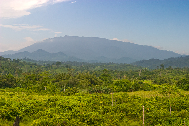
Geology and Forest Cover
The Philippine Biodiversity Management Bureau identifies three rock units beneath the mountain, namely Mt. Beaufort Ultramafics, Panas Sandstone, and Espina Basalt. The KBA assessment documents lowland rainforest in the Ilog-Ilog area northwest of the range and low-growing mossy montane forest on exposed high ridges.
During field surveys near 1,550 metres on ultramafic soil, Rainer Hutterer and colleagues recorded forest with a main canopy of 7 to 10 metres alongside patches of heath forest reaching only 2 to 3 metres in height.
A Pitcher Plant of the Upper Slopes
On 2 March 1992, G. C. G. Argent and E. M. Romero collected a pitcher-plant specimen at 1,700 metres on Mount Mantalingahan, and that collection is held at Kew. In 2007, Joachim Nerz and Andreas Wistuba formally described the species as Nepenthes mantalingajanensis.
Alastair Robinson and colleagues examined Nepenthes mantalingajanensis in the wild on Mount Mantalingahan and reported their observations alongside the 1992 herbarium specimen in a 2009 paper in the Botanical Journal of the Linnean Society.
A New Shrew Genus from the Montane Forest
A 2007 field survey on Mount Mantalingahan produced shrew specimens that Rainer Hutterer and colleagues formally described in 2018 as Palawanosorex muscorum, a new genus and species. The surveys recorded this shrew commonly between 1,550 and 1,950 metres, though the team also encountered it at 900 and 1,300 metres. The specimens were noted for dark fur and a short tail.
The mammal survey accumulated 7,083 trap-nights across the researchers' transect, where each trap-night represents a single trap set and checked over one night, giving the total effort deployed across the study area.
Sacred Land and Protected Landscape
The Philippines National Commission for UNESCO describes Mount Mantalingahan as sacred to the indigenous Palaw'an people, for whom the surrounding forested landscape constitutes ancestral land encompassing ceremonial sites and burial grounds. Proclamation No. 1815 of 23 June 2009 designated the Mantalingahan range a protected landscape of approximately 120,457 hectares, covering the municipalities of Bataraza, Brooke's Point, Quezon, Rizal, and Sofronio Española.
On 20 March 2015, the Philippines submitted the Mantalingahan Protected Landscape for addition to UNESCO's World Heritage Tentative List.