
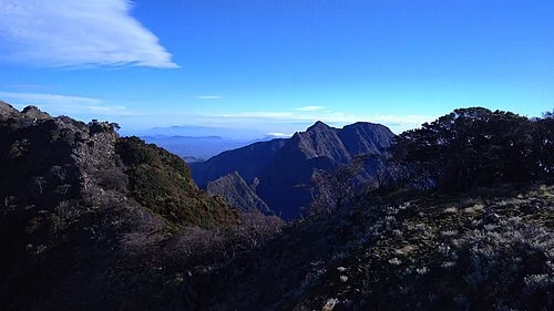
Two Names in Documentary Record
A Ministry of Education archaeological study identifies Bonthain Peak and Gunung Lompobattang as the same named landmark at 2,871 metres in the Bantaeng region, with Bonthain referencing the colonial-era designation of South Sulawesi's southern coast. An American Museum of Natural History monograph reconciles historical Bonthain Peak specimen localities with Lompobattang in documenting Bunomys rodents endemic to Sulawesi.
Caldera Rim and Volcanic Geology
Indonesia's Geological Agency examined the Lompobattang–Pencong area in the context of geothermal resources, identifying Quaternary volcanic material associated with the massif and placing a caldera rim in the vicinity of the summit zone. These features situate Lompobattang within the volcanic arc geology of Sulawesi's southern arm, shaping summit topography and highland drainage patterns.
Bantaeng River Basins and Regional Setting
The Bantaeng river basins surrounding the mountain's base contain archaeological evidence of long-term human settlement documented in the Ministry of Education study, which uses Lompobattang as a geographical anchor for the wider Bantaeng landscape. The mountain occupies the Bantaeng and Gowa highlands, with Bawakaraeng forming a separate massif and Rantemario standing in the Latimojong range to the north.