
Elevation and Summit Geometry
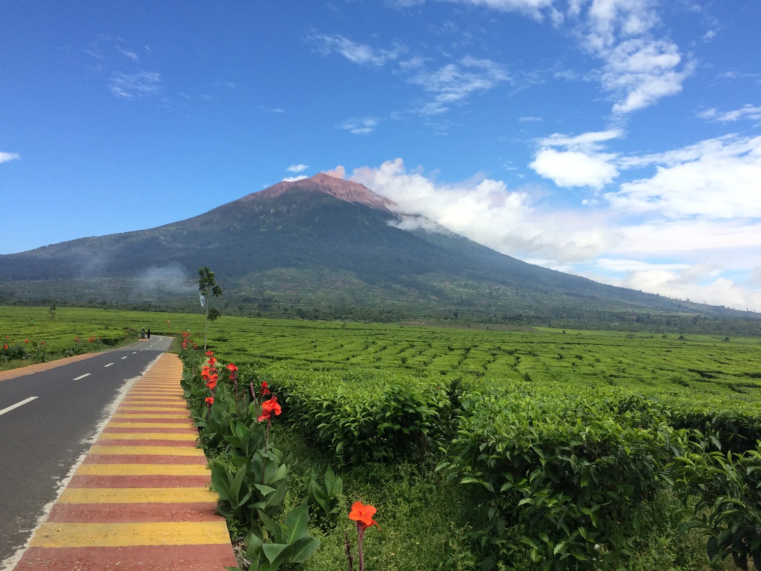
The summit elevation of Kerinci appears in authoritative sources as either 3,805 m or 3,800 m: Indonesia's World Heritage state-of-conservation report cites 3,805 m, while the Smithsonian Global Volcanism Program and the Kerinci Seblat National Park profile both give 3,800 m. The physical high point sits on the southwest rim of the summit crater, which measures roughly 600 m across. That crater is part of a younger, bare cone that grew northeast of an older remnant structure — a layered volcanic architecture reflecting successive episodes of construction and collapse over the mountain's history.
A small lake can occupy the floor of the crater on its northeast side, a feature contingent on volcanic and seasonal conditions. The bare upper cone contrasts sharply with the dense forest cover on Kerinci's lower flanks, marking the boundary between the living mountain and the landscape it dominates.
Volcanic Record
The Smithsonian Global Volcanism Program documents frequent moderate explosive episodes at Kerinci, with the first recorded eruption noted in 1838. That date marks the beginning of the written historical record, not necessarily the beginning of volcanic activity. The stratovolcano's pattern of recurrent moderate eruptions places it among the more persistently active peaks in the Indonesian archipelago, a chain built on one of the world's most volcanically productive zones.
Kerinci Seblat National Park and the Sumatran Heritage Site
Kerinci Seblat National Park, administered by Indonesia's Ministry of Forestry, encloses the mountain within a much broader protected landscape. The park is one of three national parks — alongside Gunung Leuser and Bukit Barisan Selatan — that together form the Tropical Rainforest Heritage of Sumatra, inscribed as a UNESCO World Heritage property in 2004. The composite site was designated for its exceptional biodiversity and forest integrity across a large elevational gradient, from lowland swamp forests to the montane and subalpine zones approaching peaks like Kerinci.
The Sumatran tiger is among the species of high conservation interest associated with the composite World Heritage property as a whole. The park and the broader heritage designation frame Kerinci not simply as a volcanic summit but as an anchor point for one of the last large contiguous rainforest systems in Southeast Asia — a context that shapes the mountain's significance well beyond its geological profile.
The Barisan Setting
The Barisan range runs the length of Sumatra along its western side, and Kerinci forms its highest summit. The volcanic activity at Kerinci reflects the subduction dynamics that drive much of Indonesia's geological energy. The active, exposed crater sits within a broader landscape whose forested flanks, protected within Kerinci Seblat National Park, retain ecological complexity found in few other parts of island Southeast Asia.