
A ridge divided by faults
The southeastern ridge consists of two large blocks of rock separated by faults, Piña and Carolinas. The limestones were laid down in the sea over older volcanic rock. Faulting, uplift and erosion produced steep slopes and cliffs, and left fissures in the limestone on the Carolinas Heights plateau.
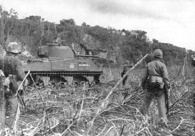
The escarpment in July 1944
Japanese troops fell back toward Tinian’s southern heights as U.S. forces advanced across the island. On 31 July 1944, heavy fighting reached the escarpment. The U.S. Marine Corps photograph shows troops and a tank below the wooded face. Caves and thick vegetation provided cover along the cliff line.
What the fissures held
In 2017, archaeologists surveyed Carolinas Heights just north of the Puntan Kastiyu headland. In one fissure they documented stacked-stone defensive walls, enamel cooking pots, bottles and fragments of bowls among military objects. Survivor accounts describe Okinawan farming families taking shelter in the caves. The archaeologists interpreted the cookware as possible evidence of civilian refuge. They also found damage from the fighting on a prewar rainwater cistern.