
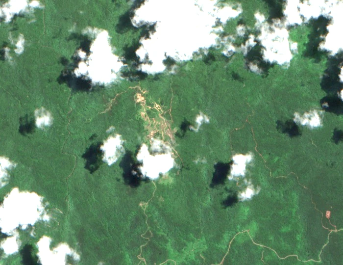
Botanical History
A. C. Smith made collections of shrubs and mosses on and around the ridge on 10 and 11 May 1934. A specimen held at the Muséum national d'Histoire naturelle in Paris, accession P01036284, preserves one of those collections as a dated herbarium record, while Bishop Museum publications document the original moss collection records from the same slopes and expedition period.
Decades later, the Key Biodiversity Areas factsheet for the Wailevu and Dreketi Highlands identifies Mount Kasi as a botanical site of note within a broader landscape characterised by mountain and lowland forests running along the island's southern spine. This regional assessment situates the ridge within a larger conservation geography without assigning it the summit elevations recorded for distinct nearby peaks such as Delaikoro, which belongs to a separate part of the KBA landscape.
Geological Structure and Gold Mineralisation
A 1987 publication through the Australasian Institute of Mining and Metallurgy placed the deposit within a Middle–Upper Miocene volcanic caldera. The study describes breccias, silica-rich alteration zones, and mineralisation characterised by gold and enargite within that caldera setting.
The 7 November 2025 Fiji parliamentary Hansard records the land and minerals minister describing the Mount Kasi prospect in the context of that date's proceedings as a mineral exploration project, providing a dated legislative reference for the named site within Fiji's mineral record.
The Ridge and Its Setting
Mount Kasi as a landform is distinct from the mine locality with which it shares a name in common usage. The named ridge occupies a position in the Yanawai area where forest cover, as documented in both the KBA assessment and Smith's 1934 field notes, characterises the surrounding terrain. The herbarium locality elevations of 300 to 430 metres recorded during Smith's collections reflect the working altitudes of that botanical survey rather than a formally determined summit height, and they are best understood as approximations tied to specific collection sites along the ridge slopes rather than to its highest point.
The Kasi ridge sits within the documented forested region of the Wailevu and Dreketi Highlands on Vanua Levu. This area's botanical communities were of sufficient interest to draw Smith's 1934 expedition, and the ridge and its surroundings have since been the subject of KBA assessments.