
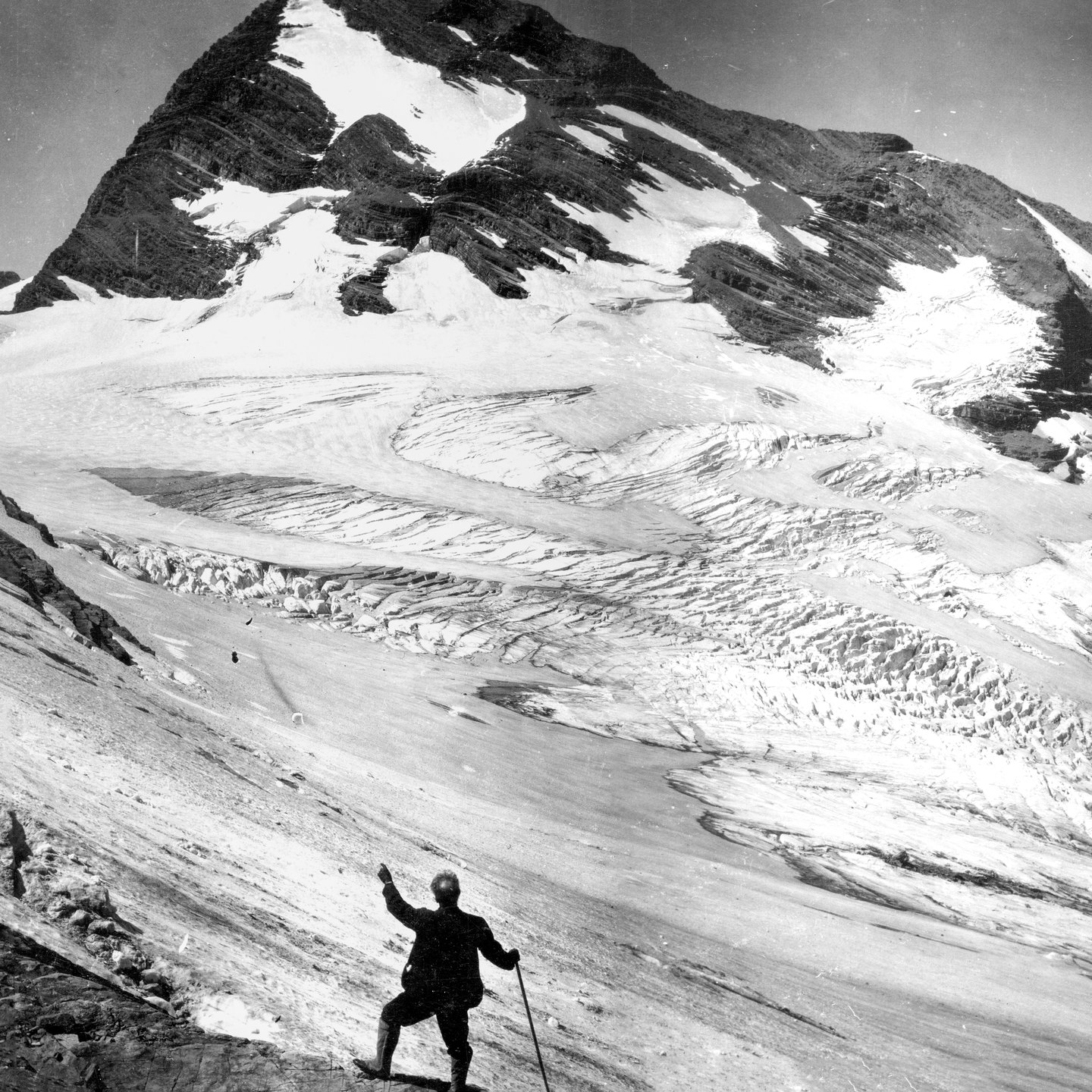
The Jackson Glacier Cirque
Jackson Glacier occupies a cirque between Mount Jackson and Blackfoot Mountain, a basin shaped by the erosive action of ice over geologic time. The glacier lies within the cirque rather than on the summit itself. USGS glaciologist William Alden photographed the glacier with Mount Jackson in the frame in 1914, producing a baseline image of the ice extent at that date. A National Park Service photograph taken from the same location in 2020 shows a markedly smaller glacier footprint. The two images together document observable change across those dates without establishing precise area measurements.
Grinnell's 1891 Naming
George Bird Grinnell's archive gives 1891 as the year he recorded names for Mount Jackson, Blackfeet Mountain, and the glacier. The name Mount Jackson entered the documented record as part of Grinnell's naming work in the region, alongside other features in the same drainage.
The Gunsight Pass Trail Record
The National Park Service historic record for the Gunsight Pass trail documents reconstruction of the east approach between 1927 and 1934. That work addressed seasonal snowbanks encountered on the mountain's flank along the trail corridor. The episode is part of the documented construction and maintenance history of the pass route, which crosses terrain below the summit.