
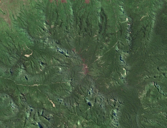
Geological Structure and Visible Relief
Geoscience Australia's field geology survey of the Kubor Anticline and surrounding Highland volcanic centres describes the summit and northern flank of Mount Ialibu as deeply dissected — characterised by heavily incised gullies and ridgelines — while the other flanks are recorded as better preserved.
The Global Volcanism Program documents field evidence of a fault crossing the Pleistocene edifice and notes an unusual lithological arrangement in which more mafic basaltic rocks occur topographically above andesitic rocks. The Geoscience Australia survey specifically associates the nearby Kara Plug with the Giluwe volcanic system rather than with Ialibu.
Position on the Highland Divide
The World Bank geographic baseline for the Southern Highlands Rural Development Project situates Mount Ialibu and the adjacent Mount Giluwe near or along the principal highland divide of the central cordillera, the ridge from which waters drain toward the Sepik drainage system to the north and toward the Purari and Kikori river basins to the south.
JICA survey mapping and the Erdkunde journal's original survey of Highland valleys and volcanic centres clarify the spatial relationship between the mountain, the settlement of Ialibu that lies below it, and the broader basin geography of the region. The town of Ialibu is a distinct place from the mountain itself, situated on lower terrain, and the two should not be conflated in geographic descriptions. Mount Giluwe, the highest of the nearby volcanic peaks, lies to the west and is a separate edifice with its own volcanic history.
Pleistocene Volcanism and Highland Context
The Global Volcanism Program classifies Mount Ialibu as Pleistocene. The GVP record is located at coordinates −6.2341, 144.0774, and the GVP-reported elevation of 3442 metres represents that source's figure for the summit, distinct from the 3465 metres in JICA and World Bank mapping.
The Erdkunde survey establishes Ialibu's place within the regional sequence of valley and summit elevations that define the central range. Field geology in this area has been complicated by the structural complexity introduced by the Kubor Anticline, a major tectonic feature whose deformation affected the distribution and preservation of volcanic rocks across a broad belt of the Highlands.