
Watershed and River Connections
The Main Divide at Mount Harrison channels meltwater and rainfall into two separate systems. On the eastern side, terrain feeds the North Mathias River, a headwater reach that joins the Mathias and then the Rakaia — a sequence recorded in the New Zealand Gazette of 9 April 1987 and reflected in the Department of Conservation's Canterbury Nature Heritage protection strategy for the Browning Ecological District. The Kā Huru Manu project of Ngāi Tahu preserves a circa-1865 Rakaia map that identifies this river system using the Māori name Rakaia-wai-pākihi for the Mathias branch, illustrating the waterways as shared by Ngāi Tahu well before European survey names were formalised.
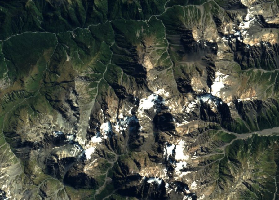
West of the crest, drainages descend into the Mungo catchment, a tributary of the Hokitika River on the West Coast. The 1908 New Zealand Geological Survey field report on the Hokitika River follows the Mungo tributary westward from the vicinity of Mount Ambrose toward Hokitika, confirming the hydrological link across the western side of the Main Divide. The 2016 EOxCloudless satellite mosaic — a composite of Copernicus Sentinel observations from 2016 and 2017, provided by EOX IT Services GmbH under CC BY 4.0 — shows the contrast directly: broad green gullies trending northwest toward the Mungo–Hokitika system, and snowier terrain on the eastern flank above the North Mathias headwaters.
Summit Terrain and Neighbouring Peaks
On the LINZ Topo50 map, the summit is marked at 2,085 metres. Omatahe Glacier lies immediately to the southeast. To the northeast stands Mount Kai Iwi at 2,070 metres; to the east, farther along the divide near Mistake Col, is Mystery Peak at 2,090 metres; and to the southwest lies Shafto Peak at 2,107 metres.
In December 1964, the New Zealand Gazette used Harrison as a landmark to locate the neighbouring Mount Kai Iwi. The board replaced that neighbour’s earlier name, Mount Collet, with effect from 15 February 1965.
Geology
The GNS Science national QMAP geology at 1:250,000 scale records Middle to Late Triassic Rakaia Terrane semischist at the summit coordinates, in textural zone IIA. The mapped description specifies slightly foliated or cleaved greywacke sandstone and argillitic mudstone, with low-grade metatuff and metachert present. In plain terms, the rock preserves original sandstone and mudstone textures while showing early signs of metamorphism — foliation and cleavage that indicate low-grade recrystallisation without erasing the original sedimentary fabric. The Triassic designation describes the history of the rock unit at regional scale. The exposed ridge and glacial cirques show the later effects of uplift and erosion.
Haast's 1866 Exploration and Place-Name Context
In March 1866, Julius Haast explored the North Mathias headwaters while seeking a practicable pass to the West Coast. On 23 March he made a pencil-and-watercolour field view at the head of the Mathias, which subsequently supplied the composition for lithographic plate 17 in his published report on the headwaters of the Rakaia River. In that view Haast labelled two individual peaks as Mt Tancred and Mt Carus; archival editors at Canterbury Museum, in a comparison of Haast's View V with the modern Mathias headwaters, have identified those two labelled peaks as present-day Shafto Peak and Mount Bryce respectively.
Read against a current map, Haast’s sketch takes in the slopes around Harrison and the peaks flanking the head of the Mathias. Kā Huru Manu records the same river system through the names used by Ngāi Tahu, including the name for the Mathias branch on the circa-1865 Rakaia map.