
Landform and Drainage
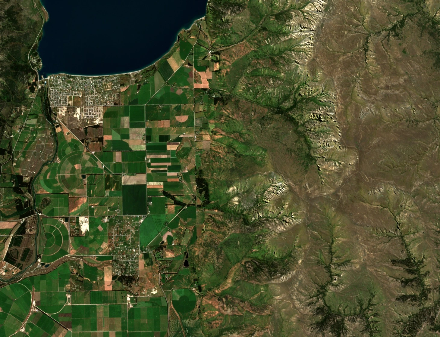
The central terrain of the station drains largely through Hospital Creek, whose catchment cuts through gorges and shingle fans shaped by both glacial action and ongoing erosion. The slopes along the Hospital and Lagoon creek drainages form part of the eastern glacial headwall of the Hāwea and Upper Clutha basin, subsequently reworked by runoff and mass movement. LINZ conservation resources documentation places the station between Hāwea Flat to the west and the higher terrain around Grandview Mountain, with exposed rock bands and erosion scars visible across the mid and upper slopes.
A Sentinel-2C true-colour image acquired on 16 December 2024 shows the south end of Lake Hāwea in the upper left, with Hāwea Flat's cultivated fields giving way on the right to the dissected slopes of the Grandview Range around Mount Grand Station. Tussock and shrubland cover significant areas of the slopes, and the broader dryland vegetation documented in Queenstown Lakes District Council's Hāwea district history includes kōwhai, matagouri, and kānuka.
Station History and Land Tenure
Lincoln University received Mount Grand through the bequest of Leslie John and Lola June Struthers in 1988. Following a Crown pastoral tenure review, 535 hectares were transferred to the conservation estate. The university now operates a 1,602-hectare research station on the remaining land, running fine-wool merino sheep and a small Angus cattle herd. Local and institutional records note research into soils, invasive species, and restoration as part of the station's academic purpose.
Erosion Risk Modelling
A 2023 study of the station applied the LUCI (Land Utilisation and Capability Indicator) landscape model to the Mount Grand Station terrain. Using nationally defined landcover inputs, the model assigned 82 percent of the study area to the highest erosion-risk category; with locally defined landcover data, that figure was 73 percent. The percentages describe modelled risk.
The study also modelled sediment connectivity — specifically, whether existing plant cover interrupts the pathways by which loose material reaches stream channels. The two landcover datasets produced different connectivity estimates, illustrating how input classification affects modelled outcomes across terrain as variable as the Hospital and Lagoon creek catchments.