
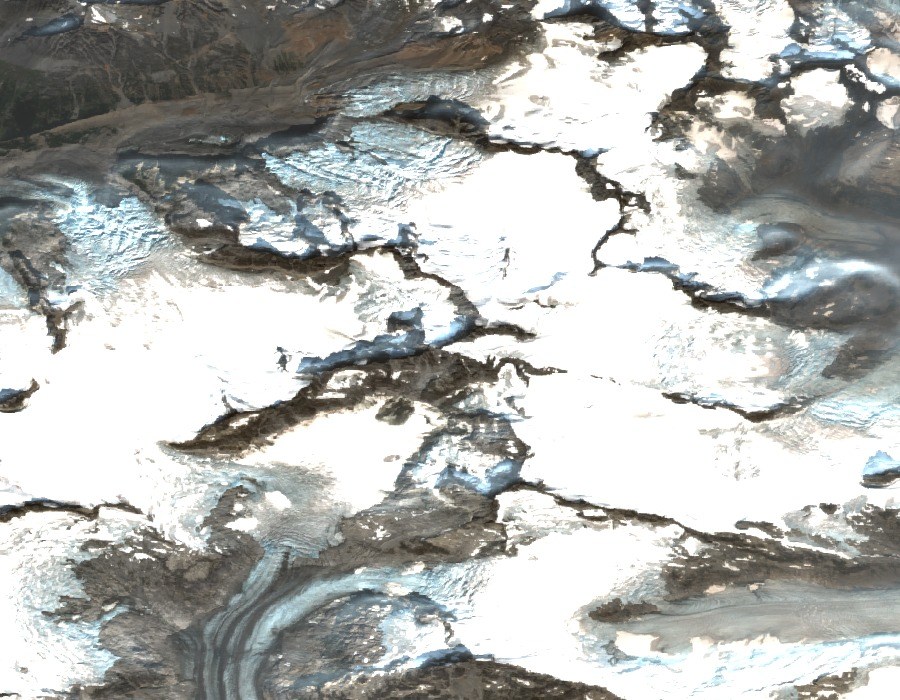
Landscape and Position
The mountain rises to about 3,120 m in the glaciated interior of the Pacific Ranges. Satellite imagery from 2025 shows bare ridgelines dividing broad areas of snow and ice, an abrupt alternation of exposed rock and glacier at this elevation. Official readings near 3,119 m from the CDEM grid align with regional assessments placing the summit at approximately 3,124 m.
The First Recorded Ascent
Neal Carter's party in August 1952 reached part of the summit ridge but missed the highest point. The first confirmed summit came on August 13, 1954, when seven climbers in Paddy Sherman's party completed the ascent, as reported in the Canadian Alpine Journal in 1955. A mining-company helicopter carried gear and climbers to the vicinity of Raleigh Glacier, not to the summit itself. Sherman noted that an eight-stage foot journey compressed into roughly twenty minutes by air, though weather had already held the party four days at the mouth of the Southgate River before the shuttle was possible.
The Southwest Ridge
In July 1989, Bruce Fairley, Bill Durrle, and Ken Legg climbed the long southwest ridge over three days, naming it The Friendly Giant. Simon Richardson's 2003 account in the Canadian Alpine Journal documents this as a separate episode from the 1954 east-face ascent, adding a second chapter of named human history to the mountain's record.