
Volcanic Structure and Summit Craters
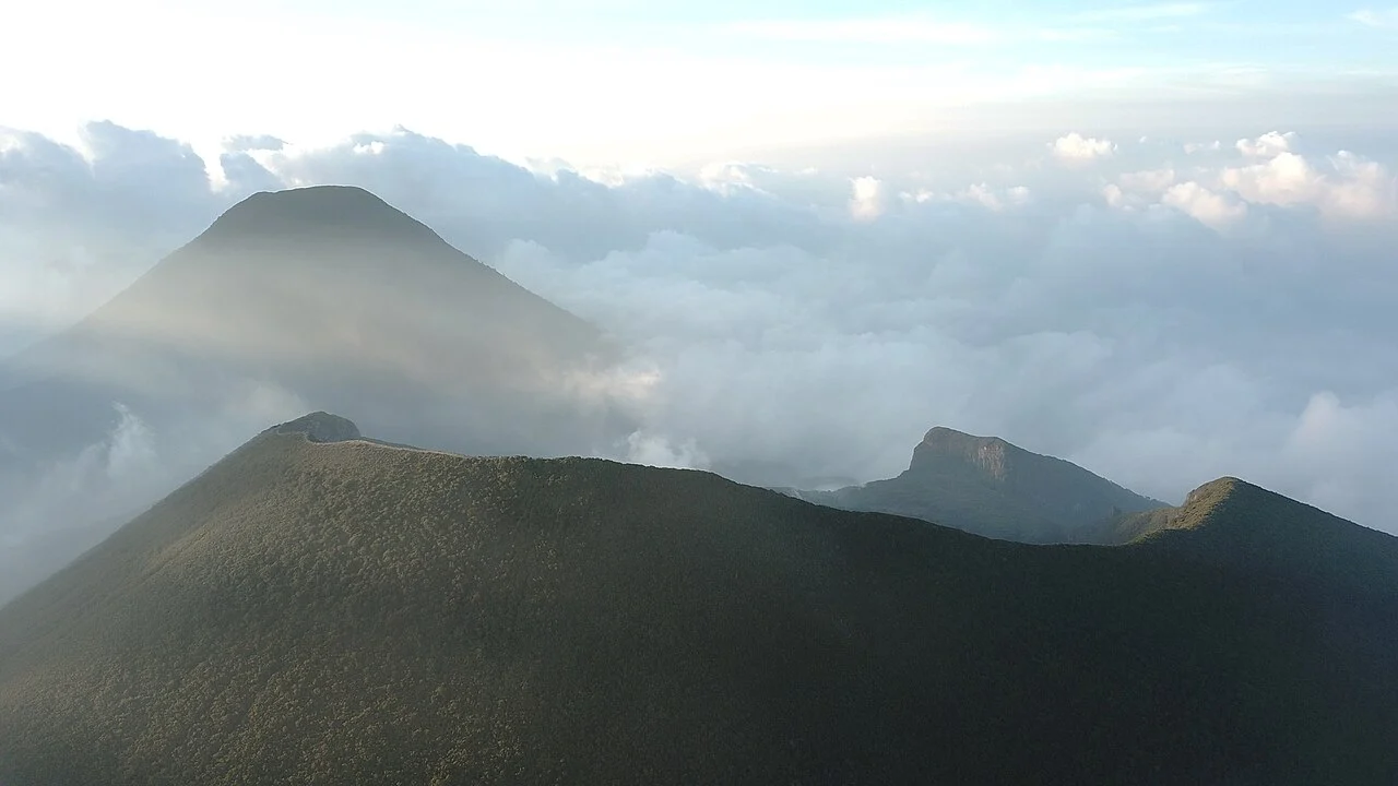
The Indonesian Forestry Ministry places Mount Gede's summit at 2,958 m, a figure that applies specifically to Gede rather than to the broader Gede-Pangrango volcanic complex, which the Smithsonian Global Volcanism Program (catalogue number 263060) profiles at a combined elevation of 3,026 m. Gede is described as a younger structure situated southeast of its neighbor Pangrango, with active summit craters and visible lava flows across its flanks. Among the documented craters are Ratu and Gumuruh — names that belong specifically to Gede's summit zone and should not be confused with the similarly named Ratu crater of Tangkuban Parahu, a separate volcano elsewhere in West Java.
Smithsonian records indicate that the steep-walled summit crater of Gede has migrated roughly one kilometer to the north-northwest over time, a measure of the volcano's evolving internal geometry. The flanks preserve evidence of two substantial debris avalanches, one of whose deposits underlie the Cianjur lowlands to the south — a geological relationship that links the mountain's ancient mass-wasting episodes directly to the populated landscape below. Small explosive activity has been recorded regularly since the sixteenth century, with a documented event in 1957 appearing in the Smithsonian eruptive history.
A Landscape Shaped by Conservation History
The forests surrounding Gede entered formal protection as early as 1925, when a colonial-era nature reserve was established in connection with the Cibodas botanical garden on the mountain's northwestern flank. In 1980, the area was designated one of Indonesia's first five national parks, administered jointly as the Gunung Gede Pangrango National Park under the Directorate General of Conservation. That shared designation links Gede administratively to Pangrango without subordinating either summit's distinct character.
The Cibodas Biosphere Reserve, nominated to UNESCO's Man and the Biosphere Programme in 1977, encompasses the humid montane ecosystem that blankets the lower and middle elevations of the complex. UNESCO records describe this as a layered ecosystem whose continuity from submontane to subalpine zones made it an early candidate for biosphere status. The reserve predates the national park designation by three years, reflecting how the site's scientific and ecological value was recognized internationally before its formal legal protection was consolidated under Indonesian national park law.
Geomorphology and the Cianjur Lowlands
Remote-sensing geomorphological surveys published by the Geological Agency of Indonesia have mapped the structural features of Gede's flanks in detail, documenting the relationship between the summit crater complex and the debris-avalanche deposits that extend toward the valleys below. The deposit underlying Cianjur represents one of the more consequential mass-wasting events in the volcano's history, shaping the topography of a densely settled lowland region that lies directly in the path of potential future flows. This geomorphological record frames Gede not simply as an isolated peak but as a system whose past behavior has left a lasting imprint on the human geography of the surrounding region.
The chronological migration of Gede's steep-walled summit crater, traceable across the volcano's distinct named craters, adds a longitudinal dimension to that record, suggesting that the eruptive focus has shifted over the mountain's history. This pattern of crater migration provides volcanologists and land-use planners with a basis for reconstructing the volcano's behavioral envelope over centuries of intermittent but persistent activity.