
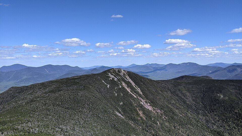
The Southern Franconia Ridge Crest
Mount Flume occupies the southernmost significant position on the Franconia Ridge, a spine that carries the Appalachian Trail through exposed terrain in the White Mountains. At 1,319 meters, recorded in feet as 4,328 on the AMC's Four Thousand Footers list, its rocky top and the adjacent Liberty summit define the southern anchor of the ridge before the terrain drops toward Franconia Notch. Mount Liberty lies to the north as a separate summit along the same corridor.
The Flume Slide
The west face of Mount Flume carries a steep, exposed scar known as the Flume Slide, a prominent bare swath visible against the wooded slopes. New Hampshire State Parks marks the trail ascending it separately on the Franconia Notch trail map, distinguishing the slide route from the standard ridge approaches. The scar is a feature of the mountain's upper shoulder and has no documented date of origin in the available sources.
Flume Gorge: A Distinct Landform
At the base of adjacent Mount Liberty—not on the flanks of Mount Flume—Flume Gorge is a stream-cut channel in fractured granite interrupted by basalt dikes. New Hampshire State Parks explains that Ice Age glaciers overrode the gorge and deposited material in it; frost action and Flume Brook continued the erosion afterward. The gorge sits at a much lower elevation than either the mountain's summit or its slide scar.
In 1883 a storm dislodged a large boulder that had been suspended across the gorge walls, forming Avalanche Falls. A period stereograph held at the Library of Congress documents the hanging boulder while it was still in place. That date marks the loss of the boulder, not the origin of the gorge or any event on the mountain above.