
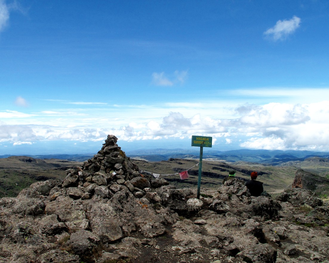
Summit Caldera and the Border Landscape
The summit region of Mount Elgon is defined by a broad caldera measuring approximately 40 square kilometres, an expanse that makes it one of the more extensive summit calderas on the continent. Wagagai, at 4,321 metres the highest of the several peaks within this summit complex, lies on the Ugandan side of the border. Mount Elgon National Park exists on both sides of the border, managed respectively by the Uganda Wildlife Authority and the Kenya Wildlife Service as components of a shared transboundary ecosystem.
Transboundary Recognition and World Heritage Status
UNESCO has engaged with Mount Elgon through two distinct and separate instruments. The transboundary biosphere reserve is an active UNESCO designation covering both the Ugandan and Kenyan sides, recognising the mountain's value as a shared catchment and biodiversity corridor. The tentative-list submission for World Heritage consideration is a Ugandan proposal and has not been inscribed; it remains in tentative status. The biosphere designation and the World Heritage proposal should not be treated as equivalent or simultaneous achievements.
Vegetation Zones and Elevation Sequence
Moving upward from the base of Mount Elgon, the landscape transitions through a succession of distinct zones described in Uganda's UNESCO submission: open savannah gives way to woodland, which yields to montane forest and then to the high moorland characteristic of the summit region. Each zone supports different assemblages of plants and animals, and together they represent an elevation gradient that is relatively intact along stretches of the mountain's slopes. This sequence is an intrinsic part of the mountain's ecological identity and its value as a research and conservation area.
Caves, Pyroclastic Deposits, and Elephant Salt Seeking
On the Kenyan flank of Mount Elgon, a series of caves including Kitum Cave occur within pyroclastic deposits. The origins of these caves are debated; researchers including Lundberg and McFarlane have described both water-related processes and modifications by animals as contributing factors, without attributing their formation wholly to either volcanism or animal action. The caves contain sodium-rich mineral salts, and Lundberg and McFarlane documented the behaviour of elephants that enter and move through the caves to lick and scrape the walls in search of these salts, which are not available in sufficient quantity in the surrounding vegetation. This mineral-seeking behaviour has been observed across multiple generations of elephants and represents an unusual ecological adaptation specific to this site.