
Geology and Place in the Wrangell Volcanic Field
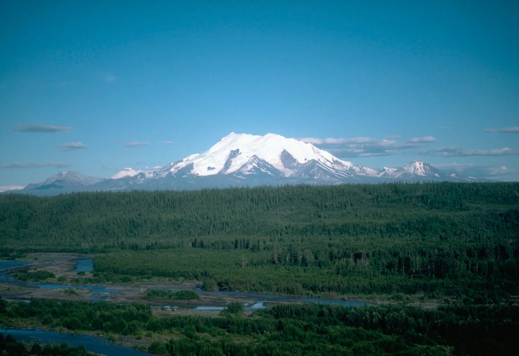
The Wrangell Mountains constitute one of North America's largest volcanic complexes, and Mount Drum occupies a geographically and chronologically distinct position within that system. As the westernmost volcano of the field, it sits apart from the younger, still-steaming peaks to the east, its eruptive history having ended well before the Pleistocene gave way to the Holocene. USGS imagery and documentation record its elevation at 3,661 metres, and the mountain's eroded profile—compared with the more sharply constructed cones of its neighbours—reflects the cumulative work of glaciation across hundreds of thousands of years since volcanism ceased.
The surrounding landscape retains the geological imprint of that volcanic past in its soils and topography, while modern ice continues to shape Drum's upper reaches. From vantage points along Glennallen-area roads, the mountain presents a wide, heavily glaciated mass rather than a classic pointed summit, a visual reminder that great age and persistent ice, not recent eruption, have been its primary sculptors.
Ahtna Heritage and the Name on the Map
Long before American survey parties reached the Copper River interior, the Ahtna people inhabited this landscape. The National Park Service records the Ahtna name for Mount Drum as Hwdaandi K'ett'aeni, a designation that predates any English cartography of the region and reflects the mountain's presence in the cultural geography of one of Alaska's oldest resident peoples. The Ahtna name stands as the original and enduring identity of the peak, grounded in a relationship with the land that stretches back far beyond the 1885 survey expedition.
The English name Mount Drum was applied by U.S. Army Lieutenant Henry T. Allen during his 1885 Copper River expedition, in honour of Adjutant General Richard Coulter Drum. Allen's journey was among the first systematic American explorations of the Copper River drainage, and his practice of naming prominent features after military figures left a series of English-language place names across a landscape the Ahtna had long known by their own terms. The GNIS record preserves both the Allen attribution and the 1885 date.
First Ascent
The summit of Mount Drum was first reached in June 1954 by Heinrich Harrer, Keith Hart, and George Schaller. The GNIS record documents the ascent month as June 1954.
That the first ascent came nearly seventy years after Allen's naming of the peak reflects the mountain's remoteness in Alaska's interior. Drum received considerably less attention than the higher Wrangell peaks, and the 1954 climb remains the foundational event in its climbing record.
Visibility and Regional Context
One of Mount Drum's most accessible qualities is its visibility. The National Park Service notes that the mountain can be seen from highways in the Glennallen area, making it one of the more readily observed major summits in Wrangell–St. Elias despite lying within a park not easily traversed by road. For travellers moving through the Copper River basin, Drum's wide glaciated mass on the western horizon offers a constant reference point and a visual introduction to the scale of the Wrangell volcanic complex.
Within the broader context of Wrangell–St. Elias—a park that contains a remarkable concentration of high peaks, including several that exceed 5,000 metres—Mount Drum occupies a quieter register. Its distinction lies not in raw altitude but in its position as the westernmost volcano of the field, its dual naming history reflecting both Ahtna presence and American survey-era cartography, and a first ascent completed in June 1954 by Heinrich Harrer, Keith Hart, and George Schaller.