
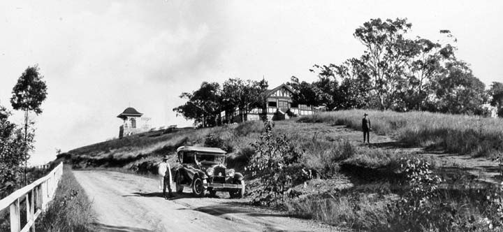
A Name Tied to Native Bees and Honey
Brisbane City Council's public interpretation links the place name Kuta — anglicised as Coot-tha — to native stingless bees and honey. The council presents this association without attributing it to a specific language group, and that care is worth preserving as a piece of documented public heritage interpretation rather than a settled linguistic claim.
From Timber Reserve to Public Recreation Ground
In 1873 the area then known as One Tree Hill was reserved as a timber supply for Queensland's railways; in 1880 it was recast for public recreation. The lookout and kiosk that followed are now heritage-listed under Brisbane City Council records, recognised for their architectural character and place in Brisbane's outdoor recreation history.
A Layered Landscape on the Taylor Range
The Taylor Range forms a visible ridgeline west of Brisbane's inner suburbs, and Mount Coot-tha is its most publicly recognised point. Separate cartographic identities for the summit, the lookout, and The Summit reflect genuine distinctions in position. No single elevation label covers all three — the absence of a unified figure faithfully describes the terrain.