
Geology of the Tengger Complex
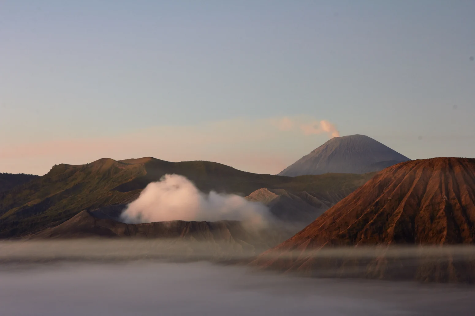
The Tengger volcanic complex has roots stretching back roughly 820,000 years, according to the Smithsonian's geological profile, which traces a succession of five overlapping, caldera-truncated volcanoes built and partially destroyed across deep time. The older Ngadisari caldera is distinct from the younger, flat-floored Sandsea depression; it is within the Sandsea that Bromo grew as a post-collapse cone, emerging as the historically active center of the complex.
The Smithsonian's Global Volcanism Program records Bromo as a pyroclastic cone at 2329 m. Historical monitoring registers intermittent ash emissions, gas, and steam, confirming the cone's ongoing volcanic character.
The Sandsea and Neighboring Cones
The younger Sandsea caldera forms the flat, ash-covered plain that immediately surrounds Bromo and gives the landscape its distinctive, almost lunar quality. Within this depression, the symmetrical profile of Batok cone stands as a prominent neighbor, rising inert alongside the still-active Bromo. The relationship between these cones — and the visual separation of the entire Tengger complex from Semeru to the south — defines the spatial logic of the broader volcanic terrain in East Java.
Yadnya Kasada and Tengger Hindu Tradition
The Pura Luhur Poten temple, situated at the foot of the Bromo crater within the Sandsea, is the ritual center of Yadnya Kasada, an annual ceremony recorded by the Indonesian Ministry of Religious Affairs. The 2019 observance documents offerings made at both the temple and the crater itself — acts of gratitude and veneration of ancestors that form the living core of Tengger Hindu practice.
The ceremony is bound to the legend of Joko Seger and Roro Anteng, a founding narrative of the Tengger people that the Ministry attributes to the origins of the Kasada tradition. The legend is precisely that — a legend, not a historical record — but its attachment to the crater gives the site a ceremonial significance that predates and outlasts any geological survey.
Protected Landscapes and Administrative Boundaries
Bromo sits within Bromo Tengger Semeru National Park, administered by Indonesia's Forestry Ministry and spanning four regencies of East Java. The park boundary encompasses the Tengger caldera complex, the Sandsea, and the high peaks to the south including Semeru. The name of the park itself signals that Bromo and Semeru, though often discussed together, are geologically and geographically distinct mountains.
Beyond the national park, UNESCO designates the broader Bromo Tengger Semeru-Arjuno Biosphere Reserve, a larger administrative zone that encompasses multiple mountains, varied ecosystems, and the extended communities of the Tengger highlands. The biosphere reserve boundary is not coextensive with the national park, and neither boundary should be conflated with the cone and active crater of Bromo itself — a distinction that matters for understanding how layers of protection and designation overlay this complex volcanic landscape.