
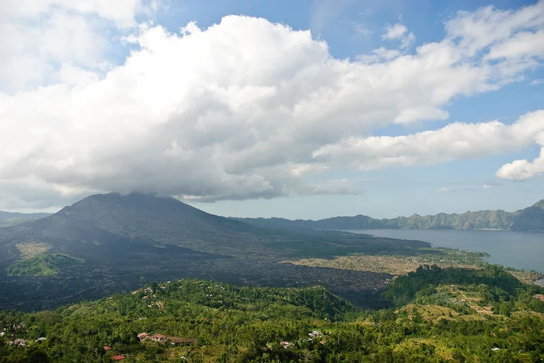
A Landscape Built by Collapse
The terrain around Mount Batur reflects two distinct episodes of caldera formation, both documented by the Smithsonian Global Volcanism Program. The outer caldera, measuring roughly 10 by 13.5 kilometres, is associated with the Bali/Ubud Ignimbrite event approximately 29,300 years ago; nested inside it, a younger depression of about 6.4 by 9.4 kilometres formed during the Gunungkawi Ignimbrite episode approximately 20,150 years ago. A caldera is not a crater but a collapse depression, produced when a volcanic magma chamber empties and the overlying ground founders. The present cone of Mount Batur is a later construction built up from lava and volcanic fragments within that inner basin, a geological sequence that makes the mountain considerably younger than the walls that frame it.
Lake Batur occupies the southeast portion of the inner caldera, pooling against and over part of the collapsed wall. The relationship between the lake and the cone — water on one side, active vent on the other — is one of the defining contrasts of the landscape. Historic basaltic lava flows from Batur have reached the caldera floor and the shores of the lake, leaving a record of eruption written directly into the terrain.
The Summit and Its Fissures
Three craters — Batur I, II, and III — mark the summit zone, their alignment governed by a northeast–southwest fissure system that cuts across the cone. The basaltic character of its historical lava flows, relatively fluid compared to more silica-rich magmas, allowed them to reach the caldera floor and lake shores, where sheets of hardened rock remain visible today.
Geopark Recognition and the Wider Cultural Landscape
UNESCO has designated Batur a Global Geopark, an acknowledgment that encompasses not only the volcanic and lacustrine geology but also the agricultural and cultural landscape that has developed around and within the caldera. The geopark framework recognizes the interconnection of the calderas, the lake, and the communities that have long inhabited this terrain, treating the human presence as inseparable from the geological story rather than incidental to it.
Mount Batur lies northwest of Mount Agung, Bali's highest and most sacred peak. The Batur volcanic complex — its two calderas, lake, and cone — preserves a detailed record of repeated volcanic collapse and renewal. Indonesia's PVMBG monitors the volcano's activity, and the Smithsonian Global Volcanism Program compiles and publishes eruption reports, reflecting Batur's status as an active system.