
Volcanic Origins and Island Relief
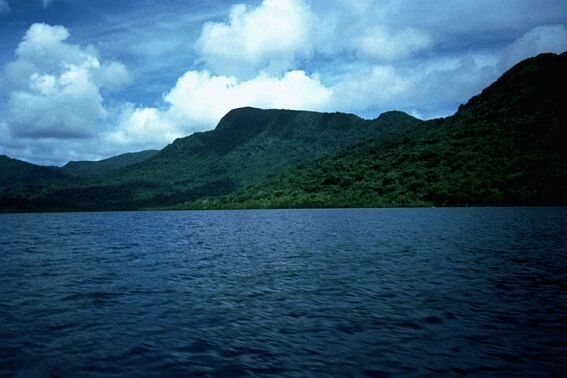
CNES describes Mount Banie as an older volcanic edifice of roughly five million years. The massif rises steeply from coastlines fringed by reef, and a 2004 photograph taken looking southwest toward the summit shows heavily forested ridges descending in successive steps from the high central spine.
The Teanu-language dictionary compiled by linguist Alexandre François distinguishes Banie, the main volcanic summit, from Popokia, a secondary peak recorded at 776 metres. Older sailing directions and botanical literature sometimes apply the names Kapogo or Popogia to the broader massif.
Forest Cover and Botanical Record
The Solomon Islands biodiversity data-gap analysis documents Vanikoro's forest cover alongside a record of historic logging activity that affected lowland areas of the island.
A Kew Bulletin revision of the Cunoniaceae family by Pillon and colleagues records the endemic tree Geissois pentaphylla from Vanikoro, attributing the locality and taxonomic classification to herbarium and field collections examined in that study. The presence of an endemic woody plant on the island is consistent with the broader pattern of biological distinctiveness observed across the high islands of Temotu Province, where volcanic relief and long isolation have produced notable levels of endemism at both the species and subspecies level.
The La Pérouse Shipwrecks and Coastal History
Vanikoro occupies a significant place in the history of Pacific exploration because of events that unfolded in its reef waters rather than on its summit. A Western Australian Museum maritime archaeological field report situates the wrecks of the French frigates Astrolabe and Boussole in reef waters off Vanikoro, where both vessels were lost in 1788 during the expedition commanded by Jean-François de Galaup, comte de La Pérouse. The ships had departed Botany Bay and disappeared without explanation; their fate remained unknown for decades before wreck materials were identified on Vanikoro's reefs.
The Western Australian Museum's archaeological documentation of the La Pérouse wreck sites connects the island's coastal reef system to the 1788 loss of the expedition's vessels.
Local Names and Survey Conventions
The Teanu dictionary uses Banie as the name of both the mountain and the island on which it stands, and extends it at times to the broader island group, while treating Banie and the neighbouring peak Popokia as clearly differentiated summits rather than zones of a single massif. The dictionary pairs these names with Teanu-language examples that reflect local geographic distinctions.
The elevation of 923 metres is treated here as the sourced convention following CNES, with 924 metres noted as a variant from the Bishop Museum survey. The mapped high point carries approximate rather than surveyed precision, and the two published figures represent the available attributed elevations for the summit.