
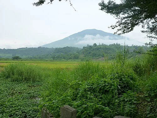
Volcanic Structure and White Rock Dome
The GVP records a west-northwest breach in Arayat's edifice from a past flank collapse, leaving hummocky avalanche deposits across the lower terrain. The White Rock lava dome formed after that collapse event. Basalt sampled from the edifice predates the collapse, establishing a relative chronology of the volcano's constructional and destructive phases. Weak steam has been observed on the northwest side.
Pampanga River and the Eastern Watershed
The Pampanga River passes on the mountain's eastern side, moving toward the Candaba wetland to the southeast. PAGASA includes Arayat within its flood forecasting framework for the Pampanga River basin, recognising that the mountain's forested slopes mediate water flow across a basin serving the surrounding lowland plain.
Republic Act 11684 and Forest Stewardship
In 2022, the Philippine government enacted Republic Act 11684, declaring Mount Arayat a protected landscape and establishing a governing board with coordination arrangements linking the municipalities of Arayat and Magalang to national conservation mandates. The Philippine Information Agency has framed the mountain's forested cover as an inheritance held in trust for future generations of Kapampangans.