
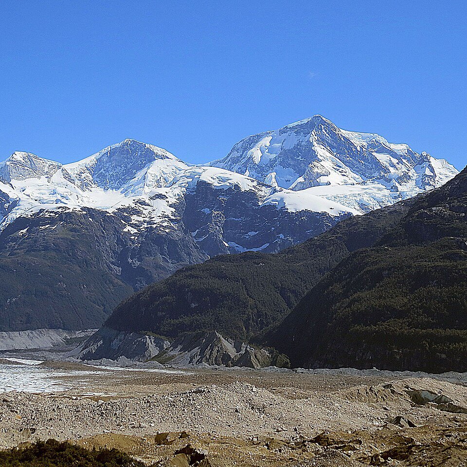
Glacial geography and the Northern Ice Field
San Valentín stands at the northern limit of the Northern Patagonian Ice Field, the largest extrapolar ice field in the Southern Hemisphere outside Antarctica. Its summit forms part of a broad high-altitude plateau extending between 3,700 and 4,030 metres, a characteristic that sets the massif apart from the needles and towers that predominate elsewhere in Patagonia. This plateau geometry favours the accumulation of névé and turns the summit into a natural archive of regional atmospheric conditions.
The relationship between the mountain and the ice cap surrounding it is not merely topographical: San Valentín acts as one of the points of maximum solid precipitation accumulation in the system, receiving Atlantic and Pacific weather systems that converge over the Patagonian Andes. The extent of the ice descending from its flanks feeds glaciers that drain toward the fjords and inland lakes of Aysén, integrating the mountain into the hydrological dynamics of the entire region.
Science on the plateau: the 2005 campaign
In March 2005, a joint Chilean-French scientific expedition carried out a firn core drilling on the summit plateau of San Valentín, work documented by Vimeux and collaborators in a subsequent publication. The team extracted a surface firn core — a layer of granular, partially compacted snow — whose analysis proved viable for environmental and climatic reconstructions. The campaign also established the reference elevation of 4,032 ± 1 metres by differential GPS, correcting the elevation shown on IGM charts.
The value of the firn core lies in the fact that annual snow layers preserve chemical and isotopic signals that researchers can link to past records of temperature, precipitation and atmospheric circulation. San Valentín, by virtue of its position at the northern end of the ice field and its elevation, offers preservation conditions distinct from those at other Patagonian drilling sites, broadening the geographical range of glaciological archives available to climate science in the Southern Cone.
Mountaineering history: from early attempts to documented ascents
Andeshandbook records that the first documented attempts to reach the summit of San Valentín date from years prior to 1952, when an Argentine party achieved the first verified ascent. The massif's isolation, its position in the interior of the ice field, and the extreme weather regime of northern Patagonia make any approach a logistically complex undertaking — factors that account for the scarcity of recorded attempts during the following decades.
The next documented mountaineering milestone dates from 1989, when an Italian team made a winter ascent according to Andeshandbook records. Choosing the austral winter implies reduced daylight and significantly lower temperatures than those of the summer season, lending this ascent a particular technical character within the history of Patagonian mountaineering. Beyond these verified dates, the chronicle of San Valentín is comparatively sparse when set against that of other emblematic summits in the region — an austerity of documentation consistent with the difficulty of access to a massif embedded in one of the most remote terrain in South America.
Geological heritage and regional context
The Universidad de Chile has included the eastern sector of Lago General Carrera — a body of water extending to the east of the Northern Ice Field — in geoheritage studies analysing the volcanic and plutonic units of the region. This geological framework places San Valentín within a territory shaped by igneous processes and by Quaternary glacial action, whose interaction has produced a landscape of singular scientific and visual value in Aysén. The mountain is therefore not solely an altimetric reference point: it forms part of a broader geological system that includes plutons, lava flows and the erosive imprint of the continental ice sheets on the Patagonian cordillera.