
Topography and Geological Context
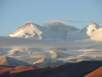
Monte Pissis forms part of a large volcanic massif situated on the boundary between the provinces of Catamarca and La Rioja, without reaching the border with Chile. Landsat 8 images recorded by CONAE in February 2016 clearly show the glaciated character of its upper reaches, with tongues of ice that contrast sharply with the dry Puna surroundings and the salt flats that extend at its base. This landscape of extreme aridity around a snow-covered volcanic edifice is one of the most distinctive visual signatures of the massif.
The official altitude has been the subject of debate over time. The IGN Argentina currently records 6,788 metres, while provincial sources from Catamarca have cited a figure of approximately 6,790 metres, noting that the reference measurement is that of the IGN. Historical expeditions from the early twentieth century produced different values — the 1902 cartography recorded 6,779 metres — and CONAE has noted that higher figures have been in circulation whose validity proved controversial. None of these discrepancies has been definitively resolved.
Nomenclature and History of the Name
The toponym Monte Pissis is relatively recent in the documentary history of the massif. Sources attribute its adoption to the Chilean geographer Francisco J. San Román during the second half of the nineteenth century, who dedicated it to the French cartographer Aimé Pissis, author of geodetic works fundamental to South American geography. Before that name became established, the massif was known in the region by different names: sources record the names Nacimiento del Jagüe and Pillanhuasi, two locally rooted toponyms that coexisted with the European name during a period of cartographic overlap.
The area also presented geographic ambiguities that complicated the identification of the massif on regional maps. The 1937 Polish expedition left documentary evidence that the available charts showed notable discrepancies and that it was necessary to distinguish carefully between Pissis and the nearby Nevado Bonete, two summits that in some representations appeared confused or interchanged. That proximity to Bonete is something contemporary sources continue to emphasise when describing the area.
The 1937 Polish Expedition
The published account of the second Polish expedition to the Andes documents the ascent of Nevado Pissis in 1937 and constitutes the most detailed written source on the early mountaineering history of the massif. The Polish expeditioners worked in a confused cartographic environment, where regional maps did not agree with one another on altitudes or on the precise identification of the summits in the area. The fact that this ascent is recorded as documented, rather than definitively established as the first ascent, reflects the caution imposed by the scarcity of earlier sources on activity on the mountain.
The expedition's narrative highlights the particular conditions of the volcanic massif: the extent of glaciated terrain at the higher elevations, the orientation of access from the Argentine altiplano, and the need to distinguish Pissis from Bonete in planning movements in the field. That account stands today as a reference document for understanding how mid-twentieth-century explorers confronted the scale and complexity of a massif that the instruments of the era still measured with considerable margins of error.
The Altimetric Debate and Its Current State
The question of Monte Pissis's exact rank in the Andean hierarchy has no unequivocal answer in the available sources. To claim that it is the highest volcano in the world or the third highest point in the Americas would require confirming both its strictly volcanic nature and the accuracy of comparative measurements — two questions that current data do not allow to be settled without reservation. The official figure from the IGN Argentina — 6,788 metres — is the most recent and carries the greatest institutional authority, but the coexistence of slightly different values in provincial sources and historical records reflects the inherent difficulty of measuring summits in this part of the Andes.
What is beyond dispute is that Monte Pissis belongs to the small group of the highest mountains on the American continent, and that its cartographic study has advanced significantly from the first nineteenth-century measurements to the satellite imagery of the twenty-first century. The 2016 CONAE image represents precisely that technological leap: where the explorers of the nineteenth century and the Polish expeditioners of the 1930s worked with field sketches carrying margins of error of tens of metres, it is now possible to analyse the glacial and volcanic morphology of the massif at a resolution that would have been inconceivable to those who gave it its name.